Pointe-Claire night lights from space
Night Light of Pointe-Claire (Quebec) from space (Canada) Src. Average luminocity for 10x10km area is 73.5% and for 50x50km: 50.7745%.
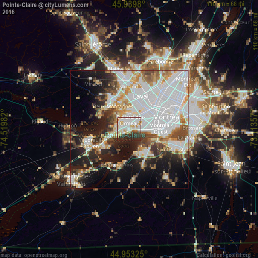
Analysis of Pointe-Claire night lights 2016
Square area 10x10 km:
 28.25%
90-99
22.7%80-89
7.46%70-79
5.87%60-69
4.6%50-59
1.43%40-49
0.63%30-39
12.38%20-29
16.35%10-19
0.32%0-9
0%Square area 50x50 km:
19.75%90-99
11%80-89
4.09%70-79
4.63%60-69
4.44%50-59
3.4%40-49
5.03%30-39
4.97%20-29
8.37%10-19
14.24%0-9
20.07%Clear (daylight) street map image can be seen on geolist.org.
Map coordinates:
45° 56' 23.3" North, 74° 31' 11.4" West
45° 26' 55.2" North, 73° 49' 0.1" West
44° 57' 11.7" North, 73° 6' 48.9" West
Some cities around Pointe-Claire sort by population:
• Dollard-Des Ormeaux
5.1 km =3.2 mi,  353°
353°
• Châteauguay
9 km =5.6 mi,  144°
144°
• Côte-Saint-Luc
11.9 km =7.4 mi,  81°
81°
• Kirkland
3.8 km =2.4 mi,  272°
272°
• Beaconsfield
4.2 km =2.6 mi,  246°
246°
• Dorval
4.9 km =3 mi,  91°
91°
• Deux-Montagnes
11.6 km =7.2 mi,  325°
325°
• Sainte-Anne-de-Bellevue
11.1 km =6.9 mi,  244°
244°
6107325 (p: 30,161)
Sources (retrieved 2019-11-25):
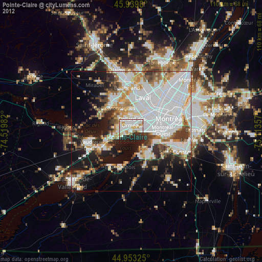
» Earth at Night: Flat Maps 2012, 2016