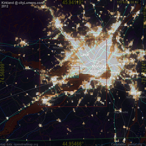
Kirkland night lights from space
Night Light of Kirkland (Quebec) from space (Canada) Src. Average luminocity for 10x10km area is 72.2127% and for 50x50km: 46.9162%.
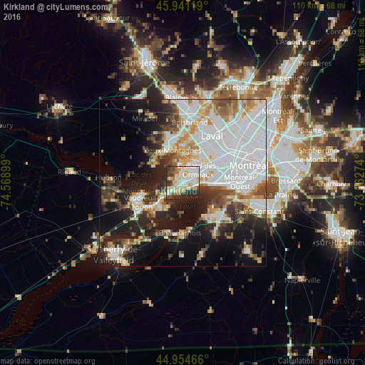
Analysis of Kirkland night lights 2016
Square area 10x10 km:
 20.79%
90-99
22.86%80-89
9.68%70-79
6.98%60-69
6.51%50-59
4.6%40-49
5.56%30-39
11.27%20-29
11.43%10-19
0.32%0-9
0%Square area 50x50 km:
17.47%90-99
9.67%80-89
3.81%70-79
4.49%60-69
4.37%50-59
3.29%40-49
4.53%30-39
5.37%20-29
8.76%10-19
15.04%0-9
23.2%Clear (daylight) street map image can be seen on geolist.org.
Map coordinates:
45° 56' 28.3" North, 74° 34' 8.4" West
45° 27' 0.3" North, 73° 51' 57.1" West
44° 57' 16.8" North, 73° 9' 45.9" West
Some cities around Kirkland sort by population:
• Dollard-Des Ormeaux
5.9 km =3.7 mi,  33°
33°
• Pointe-Claire
3.8 km =2.4 mi,  92°
92°
• Beaconsfield
1.9 km =1.2 mi,  180°
180°
• Dorval
8.8 km =5.5 mi, 92°
• Deux-Montagnes
9.8 km =6.1 mi,  343°
343°
• L'Île-Perrot
9.9 km =6.2 mi,  221°
221°
• Pointe-Calumet
9.6 km =6 mi,  305°
305°
• Sainte-Anne-de-Bellevue
7.9 km =4.9 mi,  231°
231°
5992830 (p: 20,491)
Sources (retrieved 2019-11-25):
» Earth at Night: Flat Maps 2012, 2016