Peace River night lights from space
Night Light of Peace River (Alberta) from space (Canada) Src. Average luminocity for 10x10km area is 11.0203% and for 50x50km: 0.6275%.
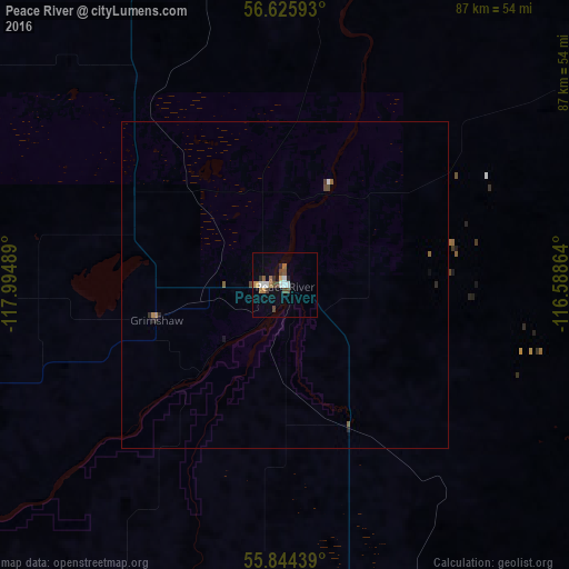
Analysis of Peace River night lights 2016
Square area 10x10 km:
 1.32%
1.32%90-99
2.03%80-89
0.72%70-79
0.48%60-69
2.39%50-59
1.2%40-49
3.23%30-39
0.72%20-29
1.08%10-19
1.2%0-9
85.65%Square area 50x50 km:
0.06%90-99
0.09%80-89
0.03%70-79
0.03%60-69
0.12%50-59
0.12%40-49
0.19%30-39
0.05%20-29
0.14%10-19
0.09%0-9
99.08%Clear (daylight) street map image can be seen on geolist.org.
Map coordinates:
56° 37' 33.3" North, 117° 59' 41.6" West
56° 14' 13.7" North, 117° 17' 30.3" West
55° 50' 39.8" North, 116° 35' 19.1" West
Some cities around Peace River sort by population:
• Grande Prairie
152.1 km =94.5 mi,  218°
218°
• Fort St. John
220 km =136.7 mi,  270°
270°
• Dawson Creek
190.8 km =118.6 mi,  253°
253°
• Hinton
316 km =196.4 mi,  183°
183°
• Whitecourt
253.4 km =157.5 mi,  156°
156°
• Morinville
356.6 km =221.6 mi,  139°
139°
• Edson
300.1 km =186.5 mi,  169°
169°
• Slave Lake
190.1 km =118.1 mi,  123°
123°
6100069 (p: 5,340)
Sources (retrieved 2019-11-25):
» Earth at Night: Flat Maps 2012, 2016