Morinville night lights from space
Night Light of Morinville (Alberta) from space (Canada) Src. Average luminocity for 10x10km area is 6.4722% and for 50x50km: 8.8275%.
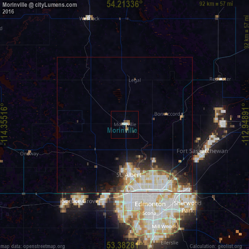
Analysis of Morinville night lights 2016
Square area 10x10 km:
 0.79%
0.79%90-99
1.32%80-89
0%70-79
1.06%60-69
0.66%50-59
1.46%40-49
1.59%30-39
1.06%20-29
0%10-19
0.53%0-9
91.53%Square area 50x50 km:
1.84%90-99
2.27%80-89
1.12%70-79
1.01%60-69
0.64%50-59
0.97%40-49
0.88%30-39
1.29%20-29
1.72%10-19
3.5%0-9
84.77%Clear (daylight) street map image can be seen on geolist.org.
Map coordinates:
54° 12' 48.1" North, 114° 21' 18.6" West
53° 48' 0.5" North, 113° 39' 7.3" West
53° 22' 58.1" North, 112° 56' 56.1" West
Some cities around Morinville sort by population:
• Edmonton
30.3 km =18.8 mi,  156°
156°
• St. Albert
18.6 km =11.6 mi,  176°
176°
• Sherwood Park
38.4 km =23.9 mi,  145°
145°
• Spruce Grove
34.5 km =21.4 mi,  210°
210°
• Fort Saskatchewan
30 km =18.6 mi,  108°
108°
• Stony Plain
37.6 km =23.4 mi,  217°
217°
• Silver Berry
42 km =26.1 mi, 154°
• Wild Rose
40.7 km =25.3 mi, 154°
6078636 (p: 8,108)
Sources (retrieved 2019-11-25):
» Earth at Night: Flat Maps 2012, 2016