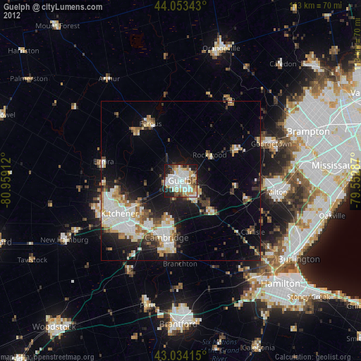
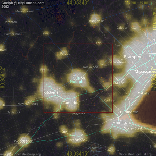
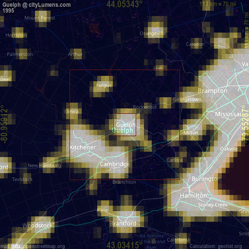
Guelph night lights from space
Night Light of Guelph (Ontario) from space (Canada) Src. Average luminocity for 10x10km area is 74.2254% and for 50x50km: 20.6642%.
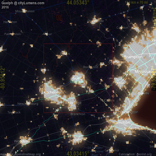
Analysis of Guelph night lights 2016
Square area 10x10 km:
 23.49%
90-99
24.76%80-89
7.14%70-79
7.94%60-69
6.98%50-59
5.4%40-49
4.13%30-39
5.71%20-29
11.27%10-19
3.17%0-9
0%Square area 50x50 km:
4.53%90-99
4.71%80-89
2.06%70-79
1.91%60-69
2.1%50-59
2.01%40-49
1.71%30-39
2.99%20-29
6.3%10-19
10.01%0-9
61.68%Clear (daylight) street map image can be seen on geolist.org.
Map coordinates:
44° 3' 12.3" North, 80° 57' 32.8" West
43° 32' 45.4" North, 80° 15' 21.6" West
43° 2' 2.9" North, 79° 33' 10.3" West
Some cities around Guelph sort by population:
• Brampton
42.3 km =26.3 mi,  68°
68°
• Kitchener
24.6 km =15.3 mi,  236°
236°
• Burlington
38.2 km =23.7 mi,  117°
117°
• Cambridge
21.2 km =13.2 mi,  192°
192°
• Milton
30.2 km =18.8 mi,  96°
96°
• Waterloo
22.8 km =14.2 mi,  247°
247°
• New Hamburg
40.1 km =24.9 mi, 243°
• Paris
39.8 km =24.7 mi, 194°
5967629 (p: 115,760)
Sources (retrieved 2019-11-25):
» NASA, Earths city lights 1995
» NASA city lights 2003
» Earth at Night: Flat Maps 2012, 2016