Oak Bay night lights from space
Night Light of Oak Bay (British Columbia) from space (Canada) Src. Average luminocity for 10x10km area is 38.571% and for 50x50km: 5.9826%.
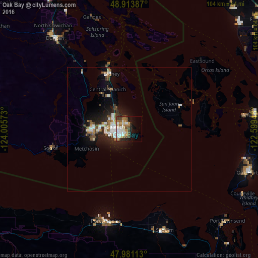
Analysis of Oak Bay night lights 2016
Square area 10x10 km:
 8.24%
8.24%90-99
9.23%80-89
3.69%70-79
4.83%60-69
6.39%50-59
4.83%40-49
5.26%30-39
3.98%20-29
5.11%10-19
14.35%0-9
34.09%Square area 50x50 km:
1.13%90-99
1.23%80-89
0.35%70-79
0.4%60-69
0.83%50-59
0.85%40-49
1%30-39
0.6%20-29
1.7%10-19
3.73%0-9
88.18%Clear (daylight) street map image can be seen on geolist.org.
Map coordinates:
48° 54' 49.9" North, 124° 0' 20.6" West
48° 26' 58.7" North, 123° 18' 9.4" West
47° 58' 52.1" North, 122° 35' 58.1" West
Some cities around Oak Bay sort by population:
• Victoria
3.9 km =2.4 mi,  247°
247°
• Langford
14.8 km =9.2 mi,  269°
269°
• Port Angeles, US
38.1 km =23.7 mi,  194°
194°
• Colwood
13.6 km =8.5 mi,  262°
262°
• North Saanich
25.6 km =15.9 mi,  340°
340°
• Salt Spring Island
43.3 km =26.9 mi, 341°
• Sequim, US
43.7 km =27.2 mi,  160°
160°
• Sooke
32.5 km =20.2 mi, 255°
6091919 (p: 18,015)
Sources (retrieved 2019-11-25):
» Earth at Night: Flat Maps 2012, 2016