Mercier night lights from space
Night Light of Mercier (Quebec) from space (Canada) Src. Average luminocity for 10x10km area is 35.2159% and for 50x50km: 34.2143%.
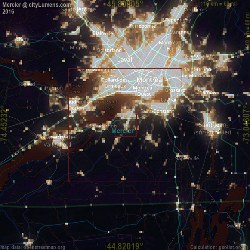
Analysis of Mercier night lights 2016
Square area 10x10 km:
 4.6%
4.6%90-99
8.25%80-89
2.06%70-79
4.92%60-69
4.29%50-59
3.65%40-49
4.13%30-39
4.44%20-29
13.97%10-19
32.22%0-9
17.46%Square area 50x50 km:
11.68%90-99
7.73%80-89
2.82%70-79
2.84%60-69
2.9%50-59
2.69%40-49
4.06%30-39
4.25%20-29
6.72%10-19
10.92%0-9
43.39%Clear (daylight) street map image can be seen on geolist.org.
Map coordinates:
45° 48' 32.6" North, 74° 27' 8.4" West
45° 19' 0.4" North, 73° 44' 57.1" West
44° 49' 12.7" North, 73° 2' 45.9" West
Some cities around Mercier sort by population:
• Châteauguay
7.4 km =4.6 mi,  0°
0°
• Pointe-Claire
15.6 km =9.7 mi,  340°
340°
• Saint-Constant
15.4 km =9.6 mi,  68°
68°
• Beaconsfield
15.8 km =9.8 mi,  324°
324°
• Dorval
14.5 km =9 mi,  358°
358°
• Beauharnois
9.6 km =6 mi,  267°
267°
• Notre-Dame-de-l'Île-Perrot
15.4 km =9.6 mi,  291°
291°
• Saint-Rémi
11.8 km =7.3 mi,  118°
118°
6072206 (p: 10,121)
Sources (retrieved 2019-11-25):
» Earth at Night: Flat Maps 2012, 2016