Longueuil night lights from space
Night Light of Longueuil (Quebec) from space (Canada) Src. Average luminocity for 10x10km area is 97.4439% and for 50x50km: 60.9985%.
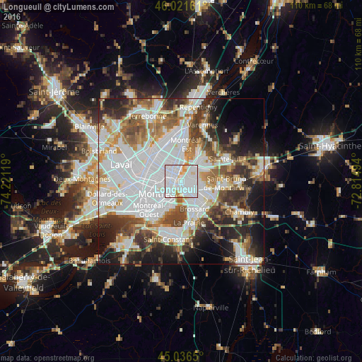
Analysis of Longueuil night lights 2016
Square area 10x10 km:
 65.61%
90-99
24.7%80-89
3.94%70-79
4.85%60-69
0.91%50-59
0%40-49
0%30-39
0%20-29
0%10-19
0%0-9
0%Square area 50x50 km:
23.08%90-99
14.13%80-89
4.66%70-79
5.5%60-69
5.72%50-59
6.04%40-49
6.97%30-39
6.75%20-29
8.99%10-19
9.07%0-9
9.08%Clear (daylight) street map image can be seen on geolist.org.
Map coordinates:
46° 1' 17.8" North, 74° 13' 16.3" West
45° 31' 52.4" North, 73° 31' 5" West
45° 2' 11.4" North, 72° 48' 53.8" West
Some cities around Longueuil sort by population:
• Montréal
6 km =3.7 mi,  245°
245°
• Saint-Laurent
12 km =7.5 mi, 253°
• Saint-Léonard
8.7 km =5.4 mi,  316°
316°
• Brossard
9.9 km =6.2 mi,  155°
155°
• Notre-Dame-de-Grâce
9.6 km =6 mi,  231°
231°
• Boucherville
9.2 km =5.7 mi,  43°
43°
• Westmount
8.3 km =5.2 mi, 229°
• Mont-Royal
10.3 km =6.4 mi,  261°
261°
6059891 (p: 229,330)
Sources (retrieved 2019-11-25):
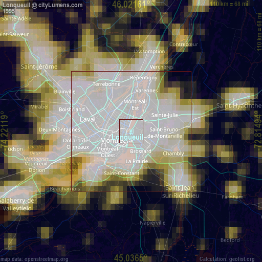
» NASA, Earths city lights 1995
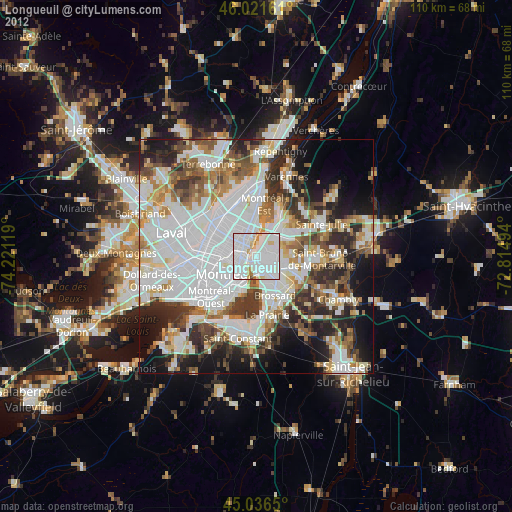
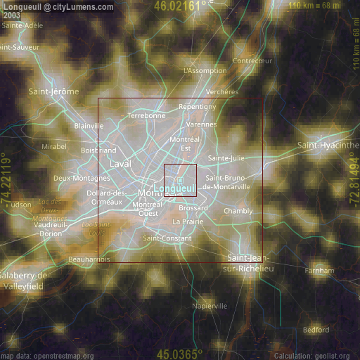
» NASA city lights 2003
» Earth at Night: Flat Maps 2012, 2016