MontrĂŠal night lights from space
Night Light of MontrĂŠal (Quebec) from space (Canada) Src. Average luminocity for 10x10km area is 98.354% and for 50x50km: 62.9504%.
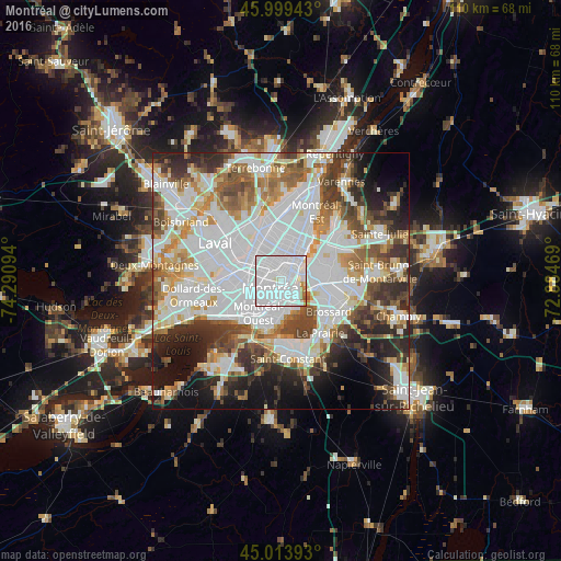

Analysis of MontrĂŠal night lights 2016
Square area 10x10 km:
 76.67%
90-99
19.05%80-89
0.48%70-79
1.9%60-69
1.59%50-59
0.32%40-49
0%30-39
0%20-29
0%10-19
0%0-9
0%Square area 50x50 km:
23.76%90-99
14.86%80-89
5.12%70-79
5.96%60-69
6.26%50-59
5.91%40-49
6.66%30-39
6.4%20-29
8.15%10-19
8.83%0-9
8.07%Clear (daylight) street map image can be seen on geolist.org.
Map coordinates:
45° 59' 57.9" North, 74° 17' 27.4" West
45° 30' 31.8" North, 73° 35' 16.1" West
45° 0' 50.1" North, 72° 53' 4.9" West
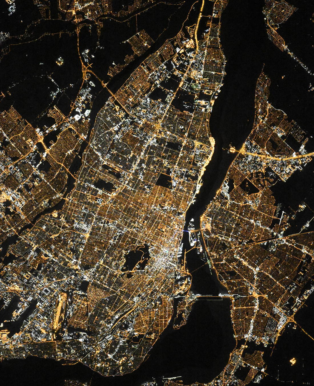
Fantastic image of MontrĂŠal from space taken by astronauts [src2], but I don't have information about it's orientation, scale or angle. If necessary, it was rotated manually, so North points approximately to upper direction. Click to zoom in:
Some cities around MontrĂŠal sort by population:
• Longueuil
6 km =3.7 mi,  65°
65°
• Saint-Laurent
6.2 km =3.9 mi,  260°
260°
• Saint-LĂŠonard
8.8 km =5.5 mi,  356°
356°
• Notre-Dame-de-Grâce
4.1 km =2.5 mi,  210°
210°
• CĂ´te-Saint-Luc
7.8 km =4.8 mi,  231°
231°
• Westmount
3 km =1.9 mi,  197°
197°
• Mont-Royal
4.9 km =3 mi,  280°
280°
• Hampstead
6.7 km =4.2 mi,  241°
241°
6077243 (p: 1,600,000)
Sources (retrieved 2019-11-25):
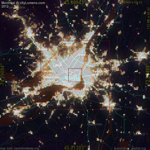
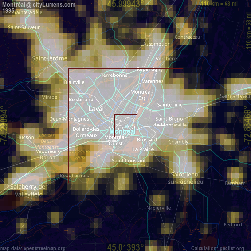
» NASA, Earths city lights 1995
» NASA city lights 2003
» Earth at Night: Flat Maps 2012, 2016
Src.2: picture by Oleg Kononenko, Roscosmos, retrieved 2019-11-29