Belmopan night lights from space
Night Light of Belmopan (Cayo) from space (Belize) Src. Average luminocity for 10x10km area is 23.2479% and for 50x50km: 1.7819%.
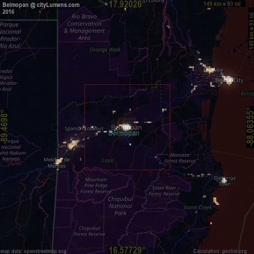
Analysis of Belmopan night lights 2016
Square area 10x10 km:
 3.72%
3.72%90-99
2.89%80-89
6.4%70-79
2.27%60-69
1.65%50-59
1.24%40-49
2.07%30-39
1.86%20-29
1.86%10-19
20.04%0-9
55.99%Square area 50x50 km:
0.15%90-99
0.11%80-89
0.49%70-79
0.19%60-69
0.2%50-59
0.15%40-49
0.37%30-39
0.21%20-29
0.15%10-19
0.99%0-9
96.99%Clear (daylight) street map image can be seen on geolist.org.
Map coordinates:
17° 55' 12.9" North, 89° 28' 11.3" West
17° 15' 0" North, 88° 46' 0" West
16° 34' 38.2" North, 88° 3' 48.8" West
Some cities around Belmopan sort by population:
• Belize City
66.5 km =41.3 mi,  65°
65°
• San Ignacio
33.7 km =20.9 mi,  252°
252°
• Orange Walk
94.9 km =59 mi,  13°
13°
• Melchor de Mencos, GT
45.8 km =28.5 mi,  243°
243°
• Dangriga
64.7 km =40.2 mi,  118°
118°
• Dolores, GT
107.4 km =66.7 mi,  220°
220°
• San Pedro
112.6 km =70 mi,  48°
48°
• Benque Viejo el Carmen
44.1 km =27.4 mi, 243°
3582672 (p: 13,381)
Sources (retrieved 2019-11-25):
» Earth at Night: Flat Maps 2012, 2016