Svyetlahorsk night lights from space
Night Light of Svyetlahorsk (Gomel Oblast) from space (Belarus) Src. Average luminocity for 10x10km area is 15.2857% and for 50x50km: 0.8528%.
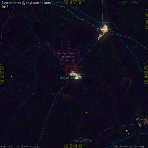
Analysis of Svyetlahorsk night lights 2016
Square area 10x10 km:
 0.93%
0.93%90-99
2.78%80-89
1.59%70-79
1.06%60-69
4.63%50-59
3.17%40-49
0.79%30-39
1.72%20-29
1.32%10-19
7.8%0-9
74.21%Square area 50x50 km:
0.05%90-99
0.11%80-89
0.06%70-79
0.08%60-69
0.19%50-59
0.21%40-49
0.07%30-39
0.08%20-29
0.1%10-19
0.54%0-9
98.5%Clear (daylight) street map image can be seen on geolist.org.
Map coordinates:
53° 3' 27.2" North, 29° 2' 8.8" East
52° 37' 58.4" North, 29° 44' 20" East
52° 12' 14.7" North, 30° 26' 31.3" East
Some cities around Svyetlahorsk sort by population:
• Babruysk
66.1 km =41.1 mi,  328°
328°
• Mazyr
73 km =45.4 mi,  207°
207°
• Zhlobin
34.7 km =21.6 mi,  33°
33°
• Rechytsa
53.5 km =33.2 mi,  124°
124°
• Kalinkavichy
62.3 km =38.7 mi, 206°
• Rahachow
55.3 km =34.4 mi,  22°
22°
• Kirawsk
72.9 km =45.3 mi,  345°
345°
• Hlusk
77 km =47.8 mi,  292°
292°
621074 (p: 71,250)
Sources (retrieved 2019-11-25):
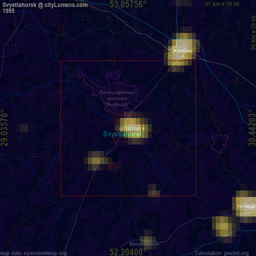
» NASA, Earths city lights 1995
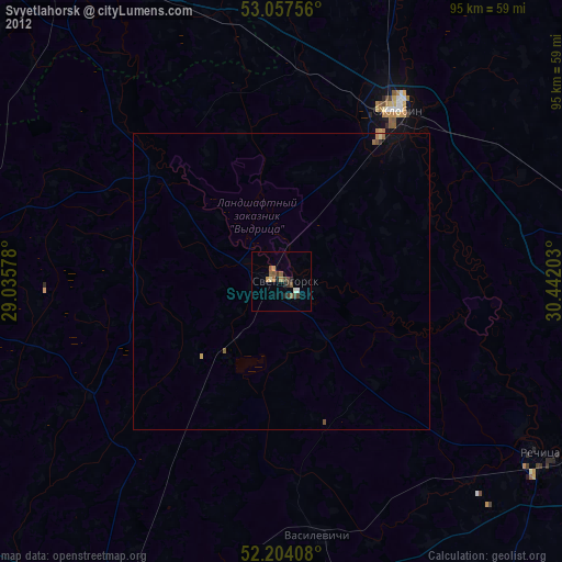
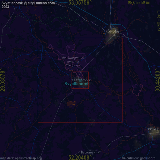
» NASA city lights 2003
» Earth at Night: Flat Maps 2012, 2016