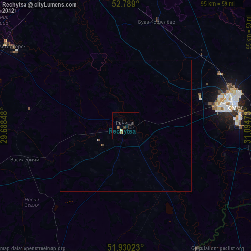
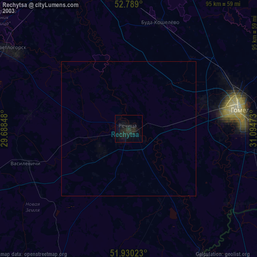
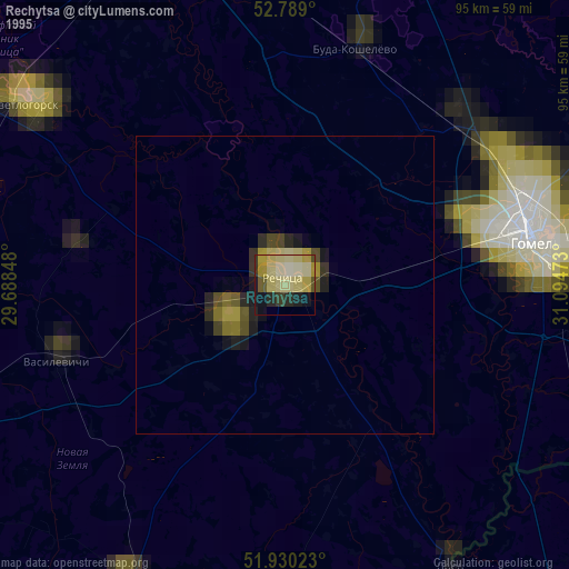
Rechytsa night lights from space
Night Light of Rechytsa (Gomel Oblast) from space (Belarus) Src. Average luminocity for 10x10km area is 2.5631% and for 50x50km: 0.1571%.
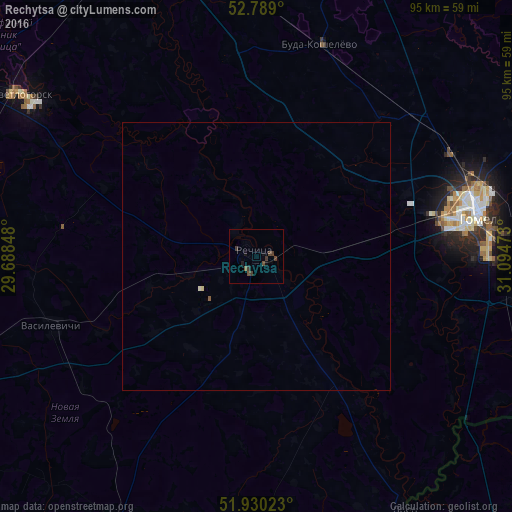
Analysis of Rechytsa night lights 2016
Square area 10x10 km:
 0%
0%90-99
0%80-89
0%70-79
0%60-69
0%50-59
0.88%40-49
1.89%30-39
2.27%20-29
0%10-19
2.02%0-9
92.93%Square area 50x50 km:
0%90-99
0.02%80-89
0.02%70-79
0%60-69
0%50-59
0.06%40-49
0.08%30-39
0.09%20-29
0%10-19
0.08%0-9
99.65%Clear (daylight) street map image can be seen on geolist.org.
Map coordinates:
52° 47' 20.4" North, 29° 41' 18.5" East
52° 21' 42.1" North, 30° 23' 29.8" East
51° 55' 48.8" North, 31° 5' 41" East
Some cities around Rechytsa sort by population:
• Homyel'
40.4 km =25.1 mi,  78°
78°
• Zhlobin
64 km =39.8 mi,  337°
337°
• Svyetlahorsk
53.5 km =33.2 mi,  304°
304°
• Dobrush
63.5 km =39.5 mi,  85°
85°
• Khoyniki
60.2 km =37.4 mi,  209°
209°
• Kastsyukowka
40.7 km =25.3 mi,  61°
61°
• Vyetka
57.7 km =35.9 mi,  67°
67°
• Loyew
53.8 km =33.4 mi,  149°
149°
622794 (p: 65,400)
Sources (retrieved 2019-11-25):
» NASA, Earths city lights 1995
» NASA city lights 2003
» Earth at Night: Flat Maps 2012, 2016