Skidel’ night lights from space
Night Light of Skidel’ (Grodnenskaya) from space (Belarus) Src. Average luminocity for 10x10km area is 2.5202% and for 50x50km: 0.9441%.
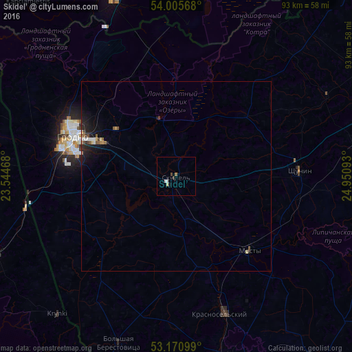
Analysis of Skidel’ night lights 2016
Square area 10x10 km:
 0.51%
0.51%90-99
0.51%80-89
0%70-79
0.51%60-69
0.51%50-59
0%40-49
0.51%30-39
0.51%20-29
0%10-19
0.51%0-9
96.46%Square area 50x50 km:
0.09%90-99
0.12%80-89
0.1%70-79
0.09%60-69
0.09%50-59
0.18%40-49
0.13%30-39
0.09%20-29
0.35%10-19
0.99%0-9
97.79%Clear (daylight) street map image can be seen on geolist.org.
Map coordinates:
54° 0' 20.4" North, 23° 32' 40.8" East
53° 35' 25.4" North, 24° 14' 52.1" East
53° 10' 15.6" North, 24° 57' 3.3" East
Some cities around Skidel’ sort by population:
• Hrodna
29.9 km =18.6 mi,  291°
291°
• Volkovysk
50.1 km =31.1 mi,  164°
164°
• Druskininkai, LT
50.3 km =31.3 mi,  340°
340°
• Mosty
27.6 km =17.1 mi,  135°
135°
• Shchuchyn
32.9 km =20.4 mi,  87°
87°
• Krasnosel’skiy
38.2 km =23.7 mi, 161°
• Ross’
35.5 km =22.1 mi, 163°
• Vyalikaya Byerastavitsa
46.5 km =28.9 mi,  199°
199°
611866 (p: 10,700)
Sources (retrieved 2019-11-25):
» Earth at Night: Flat Maps 2012, 2016