Zaslawye night lights from space
Night Light of Zaslawye (Minsk) from space (Belarus) Src. Average luminocity for 10x10km area is 5.0379% and for 50x50km: 11.5086%.
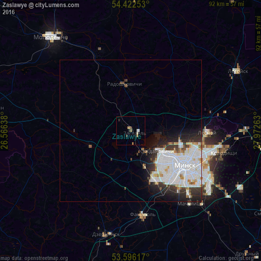
Analysis of Zaslawye night lights 2016
Square area 10x10 km:
 0.25%
0.25%90-99
1.01%80-89
0.76%70-79
1.26%60-69
0.76%50-59
0%40-49
0.25%30-39
1.26%20-29
0.63%10-19
0.38%0-9
93.43%Square area 50x50 km:
4.55%90-99
3.18%80-89
0.75%70-79
0.54%60-69
0.64%50-59
0.46%40-49
0.68%30-39
1.51%20-29
2.44%10-19
3.41%0-9
81.83%Clear (daylight) street map image can be seen on geolist.org.
Map coordinates:
54° 25' 21.1" North, 26° 33' 59" East
54° 0' 41" North, 27° 16' 10.2" East
53° 35' 46.2" North, 27° 58' 21.5" East
Some cities around Zaslawye sort by population:
• Minsk
23.1 km =14.4 mi,  122°
122°
• Kalodzishchy
34.4 km =21.4 mi,  102°
102°
• Lyasny
27.9 km =17.3 mi,  90°
90°
• Fanipol
29.4 km =18.3 mi,  171°
171°
• Machulishchy
33.5 km =20.8 mi,  140°
140°
• Rakaw
14.8 km =9.2 mi,  250°
250°
• Radashkovichy
16.1 km =10 mi,  353°
353°
• Chyst’
30.6 km =19 mi,  339°
339°
619066 (p: 13,500)
Sources (retrieved 2019-11-25):
» Earth at Night: Flat Maps 2012, 2016