Lahoysk night lights from space
Night Light of Lahoysk (Minsk) from space (Belarus) Src. Average luminocity for 10x10km area is 6.5886% and for 50x50km: 1.8157%.
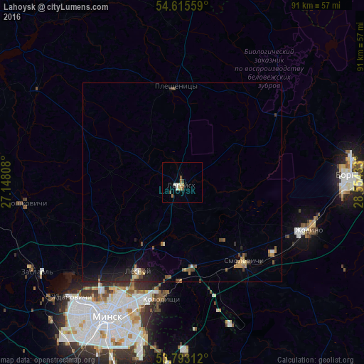
Analysis of Lahoysk night lights 2016
Square area 10x10 km:
 0.53%
0.53%90-99
1.59%80-89
1.06%70-79
1.06%60-69
0.93%50-59
0.93%40-49
0.79%30-39
0.4%20-29
0.13%10-19
0%0-9
92.59%Square area 50x50 km:
0.08%90-99
0.16%80-89
0.18%70-79
0.35%60-69
0.16%50-59
0.38%40-49
0.34%30-39
0.15%20-29
0.56%10-19
1.39%0-9
96.25%Clear (daylight) street map image can be seen on geolist.org.
Map coordinates:
54° 36' 56.1" North, 27° 8' 53.1" East
54° 12' 23" North, 27° 51' 4.3" East
53° 47' 35.2" North, 28° 33' 15.6" East
Some cities around Lahoysk sort by population:
• Minsk
38.8 km =24.1 mi,  208°
208°
• Barysaw
42.6 km =26.5 mi,  86°
86°
• Horad Zhodzina
33.6 km =20.9 mi,  110°
110°
• Kalodzishchy
29.5 km =18.3 mi,  188°
188°
• Lyasny
24.3 km =15.1 mi,  204°
204°
• Horad Smalyavichy
25.5 km =15.8 mi,  142°
142°
• Plyeshchanitsy
24.2 km =15 mi,  356°
356°
• Radashkovichy
40.1 km =24.9 mi,  261°
261°
625972 (p: 10,321)
Sources (retrieved 2019-11-25):
» Earth at Night: Flat Maps 2012, 2016