Kruhlaye night lights from space
Night Light of Kruhlaye (Mogilev) from space (Belarus) Src. Average luminocity for 10x10km area is 0% and for 50x50km: 0.0757%.
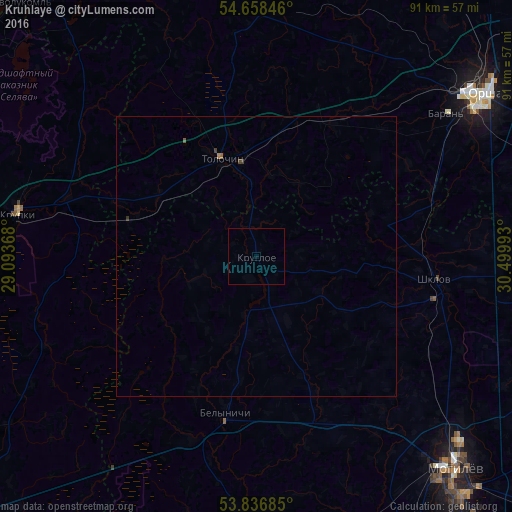
Analysis of Kruhlaye night lights 2016
Square area 10x10 km:
 0%
0%90-99
0%80-89
0%70-79
0%60-69
0%50-59
0%40-49
0%30-39
0%20-29
0%10-19
0%0-9
100%Square area 50x50 km:
0%90-99
0%80-89
0%70-79
0.01%60-69
0.03%50-59
0.03%40-49
0.03%30-39
0.06%20-29
0%10-19
0%0-9
99.86%Clear (daylight) street map image can be seen on geolist.org.
Map coordinates:
54° 39' 30.5" North, 29° 5' 37.2" East
54° 14' 58.9" North, 29° 47' 48.5" East
53° 50' 12.7" North, 30° 29' 59.7" East
Some cities around Kruhlaye sort by population:
• Mahilyow
51.5 km =32 mi,  135°
135°
• Orsha
49.4 km =30.7 mi,  54°
54°
• Novolukoml’
62 km =38.5 mi,  317°
317°
• Shklow
32.2 km =20 mi,  97°
97°
• Baran’
42.2 km =26.2 mi, 52°
• Talachyn
18.9 km =11.7 mi,  339°
339°
• Byalynichy
28.3 km =17.6 mi,  190°
190°
• Krupki
43.5 km =27 mi,  280°
280°
626491 (p: 7,300)
Sources (retrieved 2019-11-25):
» Earth at Night: Flat Maps 2012, 2016