Kapyl’ night lights from space
Night Light of Kapyl’ (Minsk) from space (Belarus) Src. Average luminocity for 10x10km area is 0.5316% and for 50x50km: 0.0243%.
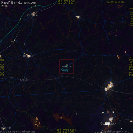
Analysis of Kapyl’ night lights 2016
Square area 10x10 km:
 0%
0%90-99
0%80-89
0%70-79
0%60-69
0%50-59
0%40-49
0%30-39
0.25%20-29
1.26%10-19
0.51%0-9
97.98%Square area 50x50 km:
0%90-99
0%80-89
0%70-79
0%60-69
0%50-59
0%40-49
0%30-39
0.01%20-29
0.05%10-19
0.02%0-9
99.92%Clear (daylight) street map image can be seen on geolist.org.
Map coordinates:
53° 34' 16.3" North, 26° 23' 17.4" East
53° 9' 5.8" North, 27° 5' 28.7" East
52° 43' 40.3" North, 27° 47' 39.9" East
Some cities around Kapyl’ sort by population:
• Salihorsk
50.5 km =31.4 mi,  143°
143°
• Slutsk
34.2 km =21.3 mi,  113°
113°
• Stowbtsy
43.1 km =26.8 mi,  327°
327°
• Nyasvizh
28.5 km =17.7 mi,  285°
285°
• Lyakhavichy
56.5 km =35.1 mi,  257°
257°
• Uzda
35.5 km =22.1 mi,  13°
13°
• Klyetsk
32.2 km =20 mi,  252°
252°
• Starobin
53.3 km =33.1 mi,  152°
152°
626956 (p: 10,500)
Sources (retrieved 2019-11-25):
» Earth at Night: Flat Maps 2012, 2016