Thamaga night lights from space
Night Light of Thamaga (Kweneng) from space (Botswana) Src. Average luminocity for 10x10km area is 3.6369% and for 50x50km: 0.6333%.
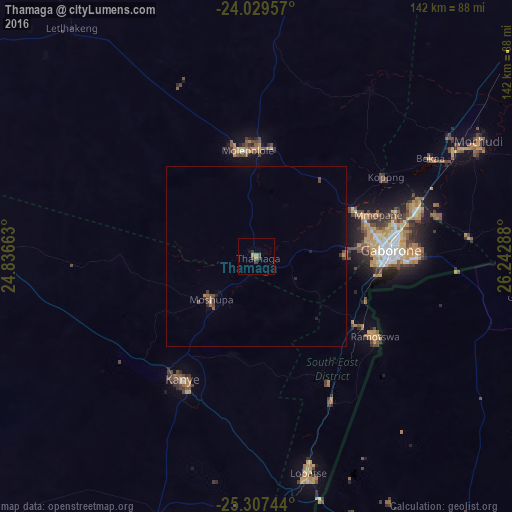
Analysis of Thamaga night lights 2016
Square area 10x10 km:
 0%
0%90-99
0%80-89
0%70-79
1.59%60-69
0.79%50-59
0.79%40-49
0.2%30-39
2.18%20-29
0.79%10-19
0.79%0-9
92.86%Square area 50x50 km:
0%90-99
0%80-89
0.03%70-79
0.09%60-69
0.07%50-59
0.17%40-49
0.23%30-39
0.26%20-29
0.16%10-19
0.1%0-9
98.88%Clear (daylight) street map image can be seen on geolist.org.
Map coordinates:
24° 1' 46.5" South, 24° 50' 11.9" East
24° 40' 12.5" South, 25° 32' 23.1" East
25° 18' 26.8" South, 26° 14' 34.4" East
Some cities around Thamaga sort by population:
• Gaborone
37.3 km =23.2 mi,  87°
87°
• Molepolole
29.7 km =18.5 mi,  351°
351°
• Kanye
39 km =24.2 mi,  212°
212°
• Mogoditshane
33.3 km =20.7 mi,  81°
81°
• Ramotswa
40.2 km =25 mi,  123°
123°
• Mosopa
16.4 km =10.2 mi,  226°
226°
• Gabane
24.5 km =15.2 mi, 89°
• Metsemotlhaba
29.7 km =18.5 mi,  63°
63°
933018 (p: 20,756)
Sources (retrieved 2019-11-25):
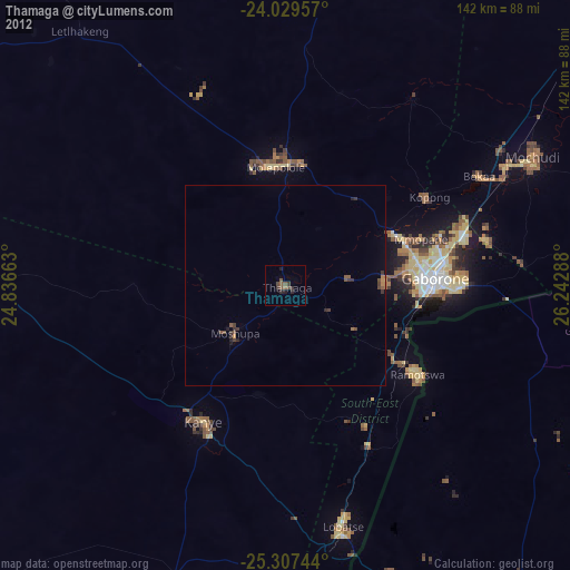
» Earth at Night: Flat Maps 2012, 2016