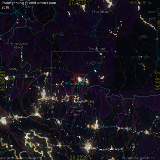
Phuntsholing night lights from space
Night Light of Phuntsholing (Chukha) from space (Bhutan) Src. Average luminocity for 10x10km area is 20.3214% and for 50x50km: 4.6423%.
Analysis of Phuntsholing night lights 2016
Square area 10x10 km:
 4.76%
4.76%90-99
3.17%80-89
0.99%70-79
0.6%60-69
0%50-59
1.39%40-49
6.55%30-39
2.98%20-29
3.37%10-19
21.23%0-9
54.96%Square area 50x50 km:
0.51%90-99
0.59%80-89
0.18%70-79
0.25%60-69
0.45%50-59
0.82%40-49
1.03%30-39
1.29%20-29
1.25%10-19
1.98%0-9
91.66%Clear (daylight) street map image can be seen on geolist.org.
Map coordinates:
27° 28' 38" North, 88° 41' 6.9" East
26° 51' 5.9" North, 89° 23' 18.1" East
26° 13' 21.4" North, 90° 5' 29.4" East
Some cities around Phuntsholing sort by population:
• Jaigaon, IN
1.3 km =0.8 mi,  250°
250°
• Goyerkāta, IN
39.8 km =24.7 mi,  244°
244°
• Alīpur Duār, IN
43.1 km =26.8 mi,  161°
161°
• Hāsimāra, IN
12.1 km =7.5 mi,  196°
196°
• Birpara, IN
29.2 km =18.1 mi, 235°
• Fālākāta, IN
41.2 km =25.6 mi,  206°
206°
• Samtse
29.1 km =18.1 mi,  280°
280°
• Tsimasham
31.1 km =19.3 mi,  28°
28°
1252484 (p: 17,043)
Sources (retrieved 2019-11-25):
» Earth at Night: Flat Maps 2012, 2016