Gasa night lights from space
Night Light of Gasa from space (Bhutan) Src. Average luminocity for 10x10km area is 0% and for 50x50km: 0.0076%.
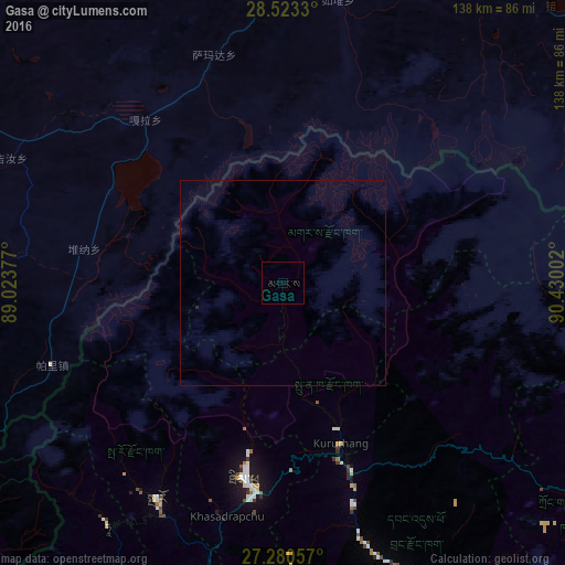
Analysis of Gasa night lights 2016
Square area 10x10 km:
 0%
0%90-99
0%80-89
0%70-79
0%60-69
0%50-59
0%40-49
0%30-39
0%20-29
0%10-19
0%0-9
100%Square area 50x50 km:
0%90-99
0%80-89
0%70-79
0%60-69
0%50-59
0%40-49
0%30-39
0%20-29
0.03%10-19
0%0-9
99.97%Clear (daylight) street map image can be seen on geolist.org.
Map coordinates:
28° 31' 23.9" North, 89° 1' 25.6" East
27° 54' 13.4" North, 89° 43' 36.8" East
27° 16' 50.1" North, 90° 25' 48.1" East
Some cities around Gasa sort by population:
• Thimphu
49.4 km =30.7 mi,  189°
189°
• Punākha
37.8 km =23.5 mi,  156°
156°
• Wangdue Phodrang
49.4 km =30.7 mi, 159°
• Tsimasham
91.4 km =56.8 mi, 191°
• Trongsa
88.8 km =55.2 mi,  120°
120°
• Paro
61 km =37.9 mi,  210°
210°
• Ha
72.3 km =44.9 mi,  217°
217°
• Lungtenzampa
49.1 km =30.5 mi, 189°
1252578 (p: 548)
Sources (retrieved 2019-11-25):
» Earth at Night: Flat Maps 2012, 2016