Daga night lights from space
Night Light of Daga (Dagana) from space (Bhutan) Src. Average luminocity for 10x10km area is 1.0675% and for 50x50km: 1.0462%.
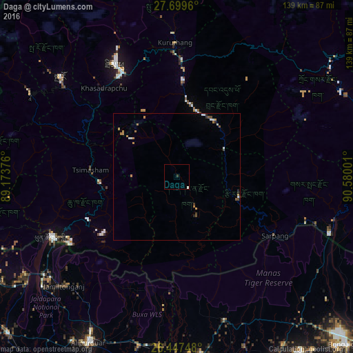
Analysis of Daga night lights 2016
Square area 10x10 km:
 0%
0%90-99
0.79%80-89
0%70-79
0%60-69
0%50-59
0%40-49
0%30-39
0.79%20-29
0%10-19
0%0-9
98.41%Square area 50x50 km:
0.1%90-99
0.21%80-89
0.04%70-79
0.28%60-69
0.17%50-59
0.11%40-49
0.16%30-39
0.09%20-29
0.17%10-19
0%0-9
98.68%Clear (daylight) street map image can be seen on geolist.org.
Map coordinates:
27° 41' 58.6" North, 89° 10' 25.5" East
27° 4' 31" North, 89° 52' 36.8" East
26° 26' 50.9" North, 90° 34' 48" East
Some cities around Daga sort by population:
• Jaigaon, IN
55.8 km =34.7 mi,  243°
243°
• Thimphu
49.3 km =30.6 mi,  331°
331°
• Tsirang
25.1 km =15.6 mi,  103°
103°
• Phuntsholing
54.4 km =33.8 mi, 242°
• Sarpang
45.3 km =28.1 mi,  121°
121°
• Wangdue Phodrang
45.7 km =28.4 mi,  2°
2°
• Tsimasham
33.8 km =21 mi,  274°
274°
• Lungtenzampa
49.4 km =30.7 mi, 332°
1252433 (p: 2,243)
Sources (retrieved 2019-11-25):
» Earth at Night: Flat Maps 2012, 2016