Upanema night lights from space
Night Light of Upanema (Rio Grande do Norte) from space (Brazil) Src. Average luminocity for 10x10km area is 4.4339% and for 50x50km: 0.699%.
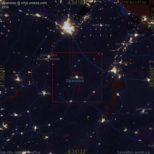
Analysis of Upanema night lights 2016
Square area 10x10 km:
 0.83%
0.83%90-99
0.83%80-89
0.83%70-79
0%60-69
0%50-59
1.86%40-49
0.62%30-39
0%20-29
0.41%10-19
0.41%0-9
94.21%Square area 50x50 km:
0.09%90-99
0.15%80-89
0.1%70-79
0.03%60-69
0.03%50-59
0.2%40-49
0.15%30-39
0.08%20-29
0.07%10-19
0.12%0-9
98.97%Clear (daylight) street map image can be seen on geolist.org.
Map coordinates:
4° 56' 30.6" South, 37° 57' 39.3" West
5° 38' 31" South, 37° 15' 28" West
6° 20' 28.4" South, 36° 33' 16.8" West
Some cities around Upanema sort by population:
• Mossoró
51.4 km =31.9 mi,  349°
349°
• Açu
39.3 km =24.4 mi,  79°
79°
• Apodi
59.9 km =37.2 mi,  267°
267°
• Caraúbas
37.1 km =23.1 mi,  243°
243°
• Jucurutu
50.9 km =31.6 mi,  148°
148°
• Patu
66.8 km =41.5 mi,  218°
218°
• Belém do Brejo do Cruz
68.1 km =42.3 mi,  206°
206°
• Governador Dix Sept Rosado
35.5 km =22.1 mi,  304°
304°
3385736 (p: 6,704)
Sources (retrieved 2019-11-25):
» Earth at Night: Flat Maps 2012, 2016