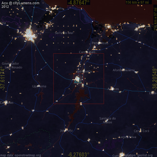
Açu night lights from space
Night Light of Açu (Rio Grande do Norte) from space (Brazil) Src. Average luminocity for 10x10km area is 31.4298% and for 50x50km: 3.4061%.

Analysis of Açu night lights 2016
Square area 10x10 km:
 4.34%
4.34%90-99
7.85%80-89
5.17%70-79
1.65%60-69
1.24%50-59
3.51%40-49
4.96%30-39
2.07%20-29
4.55%10-19
44.83%0-9
19.83%Square area 50x50 km:
0.22%90-99
0.52%80-89
0.53%70-79
0.16%60-69
0.27%50-59
0.72%40-49
0.66%30-39
0.56%20-29
0.48%10-19
2.4%0-9
93.48%Clear (daylight) street map image can be seen on geolist.org.
Map coordinates:
4° 52' 35.3" South, 37° 36' 42.3" West
5° 34' 36" South, 36° 54' 31" West
6° 16' 33.7" South, 36° 12' 19.8" West
Some cities around Açu sort by population:
• Mossoró
64.8 km =40.3 mi,  311°
311°
• Macau
59.6 km =37 mi,  30°
30°
• Jucurutu
52.3 km =32.5 mi,  193°
193°
• Pendências
40.8 km =25.4 mi, 30°
• Santana do Matos
50.8 km =31.6 mi,  146°
146°
• Angicos
35.4 km =22 mi,  106°
106°
• Afonso Bezerra
45.4 km =28.2 mi,  78°
78°
• Upanema
39.3 km =24.4 mi,  259°
259°
3408337 (p: 36,125)
Sources (retrieved 2019-11-25):
» Earth at Night: Flat Maps 2012, 2016