Terra Nova night lights from space
Night Light of Terra Nova (Bahia) from space (Brazil) Src. Average luminocity for 10x10km area is 0.0103% and for 50x50km: 0.7884%.
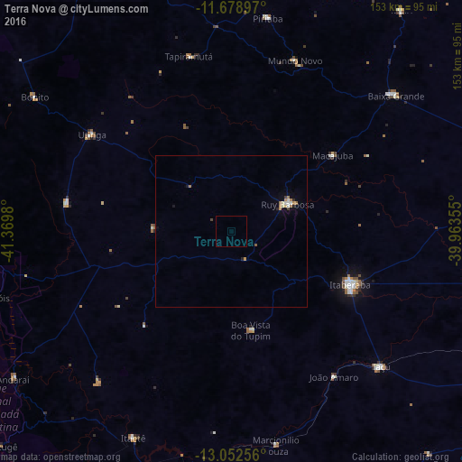
Analysis of Terra Nova night lights 2016
Square area 10x10 km:
 0%
0%90-99
0%80-89
0%70-79
0%60-69
0%50-59
0%40-49
0%30-39
0%20-29
0%10-19
0%0-9
100%Square area 50x50 km:
0.09%90-99
0.08%80-89
0.08%70-79
0.12%60-69
0.19%50-59
0.1%40-49
0.07%30-39
0.03%20-29
0.13%10-19
0.09%0-9
99%Clear (daylight) street map image can be seen on geolist.org.
Map coordinates:
11° 40' 44.3" South, 41° 22' 11.3" West
12° 22' 0" South, 40° 40' 0" West
13° 3' 9.2" South, 39° 57' 48.8" West
Some cities around Terra Nova sort by population:
• Itaberaba
43 km =26.7 mi,  114°
114°
• Vera Cruz
49.6 km =30.8 mi,  233°
233°
• Iaçu
66.5 km =41.3 mi,  132°
132°
• Ruy Barbosa
20.9 km =13 mi,  63°
63°
• Tapiramutá
59.3 km =36.8 mi,  346°
346°
• Piritiba
71.8 km =44.6 mi,  9°
9°
• Mundo Novo
60.3 km =37.5 mi,  20°
20°
• Baixa Grande
70.6 km =43.9 mi,  50°
50°
3446587 (p: 11,169)
Sources (retrieved 2019-11-25):
» Earth at Night: Flat Maps 2012, 2016