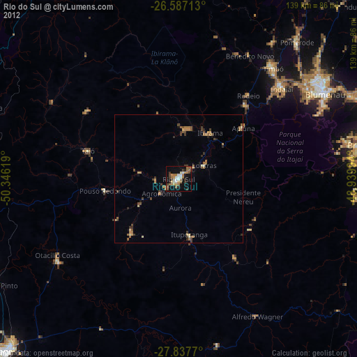
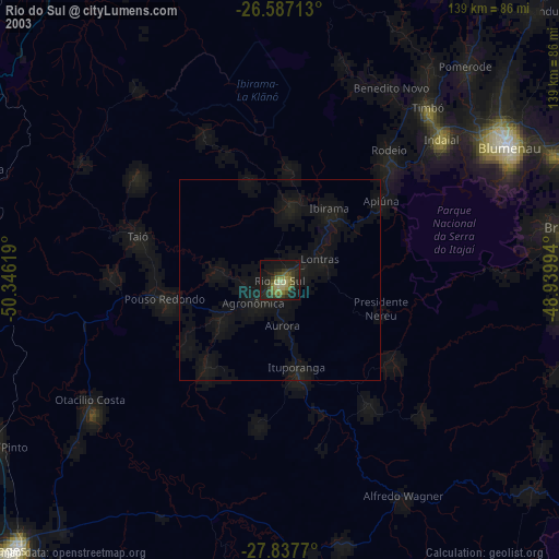
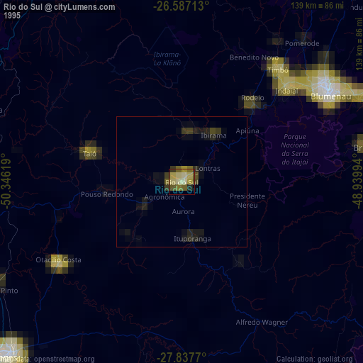
Rio do Sul night lights from space
Night Light of Rio do Sul (Santa Catarina) from space (Brazil) Src. Average luminocity for 10x10km area is 28.3049% and for 50x50km: 4.0571%.

Analysis of Rio do Sul night lights 2016
Square area 10x10 km:
 2.08%
2.08%90-99
3.22%80-89
3.6%70-79
3.6%60-69
5.68%50-59
9.47%40-49
2.65%30-39
0.95%20-29
2.65%10-19
35.04%0-9
31.06%Square area 50x50 km:
0.16%90-99
0.23%80-89
0.43%70-79
0.36%60-69
0.71%50-59
1.56%40-49
0.61%30-39
0.81%20-29
0.7%10-19
1.76%0-9
92.68%Clear (daylight) street map image can be seen on geolist.org.
Map coordinates:
26° 35' 13.7" South, 50° 20' 46.3" West
27° 12' 51" South, 49° 38' 35" West
27° 50' 15.7" South, 48° 56' 23.8" West
Some cities around Rio do Sul sort by population:
• Blumenau
65.9 km =40.9 mi,  60°
60°
• Brusque
73.4 km =45.6 mi,  79°
79°
• Indaial
53.8 km =33.4 mi,  49°
49°
• Timbó
56.9 km =35.4 mi,  40°
40°
• Pomerode
70 km =43.5 mi, 41°
• Ibirama
21.4 km =13.3 mi, 35°
• Otacílio Costa
56 km =34.8 mi,  237°
237°
• Residencia Moacir PU5BHV
43.6 km =27.1 mi, 39°
3451152 (p: 51,944)
Sources (retrieved 2019-11-25):
» NASA, Earths city lights 1995
» NASA city lights 2003
» Earth at Night: Flat Maps 2012, 2016