Prudentópolis night lights from space
Night Light of Prudentópolis (Paraná) from space (Brazil) Src. Average luminocity for 10x10km area is 17.1845% and for 50x50km: 1.0728%.
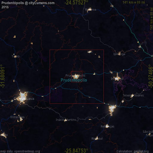
Analysis of Prudentópolis night lights 2016
Square area 10x10 km:
 0.99%
0.99%90-99
2.38%80-89
1.39%70-79
2.58%60-69
5.16%50-59
4.17%40-49
1.79%30-39
1.39%20-29
0%10-19
0.79%0-9
79.37%Square area 50x50 km:
0.05%90-99
0.16%80-89
0.09%70-79
0.16%60-69
0.29%50-59
0.23%40-49
0.13%30-39
0.11%20-29
0.05%10-19
0.12%0-9
98.6%Clear (daylight) street map image can be seen on geolist.org.
Map coordinates:
24° 34' 31" South, 51° 40' 51.3" West
25° 12' 47" South, 50° 58' 40" West
25° 50' 51.1" South, 50° 16' 28.8" West
Some cities around Prudentópolis sort by population:
• Ponta Grossa
83.2 km =51.7 mi,  80°
80°
• Guarapuava
52.8 km =32.8 mi,  248°
248°
• Irati
43.3 km =26.9 mi,  130°
130°
• Imbituva
37.6 km =23.4 mi,  92°
92°
• Pinhão
87 km =54.1 mi,  231°
231°
• Carambeí
91.5 km =56.9 mi,  71°
71°
• Reserva
63.9 km =39.7 mi,  11°
11°
• Cândido de Abreu
80.3 km =49.9 mi,  333°
333°
3452216 (p: 19,611)
Sources (retrieved 2019-11-25):
» Earth at Night: Flat Maps 2012, 2016