Pontal do Paraná night lights from space
Night Light of Pontal do Paraná (Paraná) from space (Brazil) Src. Average luminocity for 10x10km area is 16.5322% and for 50x50km: 8.4439%.
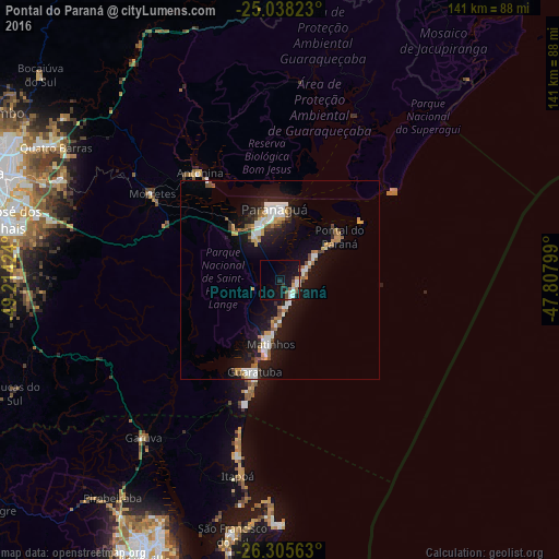
Analysis of Pontal do Paraná night lights 2016
Square area 10x10 km:
 2.65%
2.65%90-99
2.65%80-89
1.14%70-79
1.89%60-69
1.52%50-59
2.27%40-49
1.7%30-39
1.33%20-29
1.7%10-19
23.67%0-9
59.47%Square area 50x50 km:
1.37%90-99
1.44%80-89
0.59%70-79
1.06%60-69
0.9%50-59
1.04%40-49
0.64%30-39
0.91%20-29
1.55%10-19
9.71%0-9
80.79%Clear (daylight) street map image can be seen on geolist.org.
Map coordinates:
25° 2' 17.6" South, 49° 12' 51.3" West
25° 40' 25" South, 48° 30' 40" West
26° 18' 20.3" South, 47° 48' 28.8" West
Some cities around Pontal do Paraná sort by population:
• Paranaguá
17.6 km =10.9 mi,  355°
355°
• São José dos Pinhais
71.7 km =44.6 mi,  282°
282°
• Piraquara
61.5 km =38.2 mi,  294°
294°
• São Francisco do Sul
64.6 km =40.1 mi,  191°
191°
• Campina Grande do Sul
68.2 km =42.4 mi,  306°
306°
• Guaratuba
24.1 km =15 mi,  195°
195°
• Quatro Barras
66.3 km =41.2 mi,  301°
301°
• Antonina
33.9 km =21.1 mi,  323°
323°
3478424 (p: 14,969)
Sources (retrieved 2019-11-25):
» Earth at Night: Flat Maps 2012, 2016