Antonina night lights from space
Night Light of Antonina (Paraná) from space (Brazil) Src. Average luminocity for 10x10km area is 11.6845% and for 50x50km: 4.3375%.
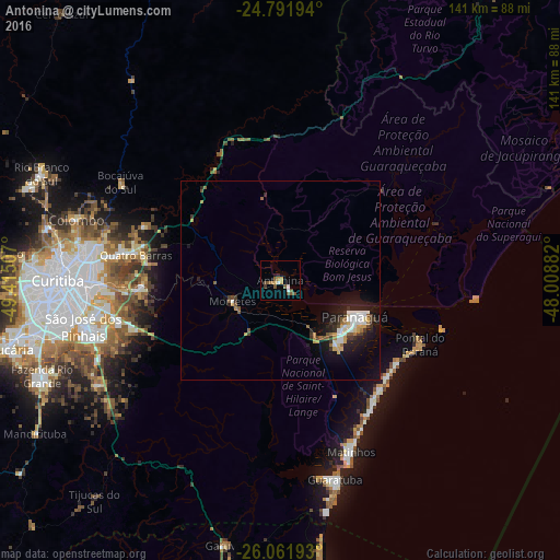
Analysis of Antonina night lights 2016
Square area 10x10 km:
 1.19%
1.19%90-99
1.19%80-89
0.79%70-79
1.59%60-69
1.59%50-59
5.36%40-49
1.79%30-39
0.79%20-29
1.19%10-19
0.6%0-9
83.93%Square area 50x50 km:
0.72%90-99
0.65%80-89
0.4%70-79
0.46%60-69
0.45%50-59
0.67%40-49
0.4%30-39
0.69%20-29
1.1%10-19
3.49%0-9
90.97%Clear (daylight) street map image can be seen on geolist.org.
Map coordinates:
24° 47' 31" South, 49° 24' 54.3" West
25° 25' 43" South, 48° 42' 43" West
26° 3' 42.9" South, 48° 0' 31.8" West
Some cities around Antonina sort by population:
• Paranaguá
21.1 km =13.1 mi,  117°
117°
• São José dos Pinhais
51.1 km =31.8 mi,  257°
257°
• Pinhais
48.3 km =30 mi,  267°
267°
• Piraquara
35.8 km =22.2 mi, 267°
• Campina Grande do Sul
37.1 km =23.1 mi,  291°
291°
• Guaratuba
52.3 km =32.5 mi,  164°
164°
• Quatro Barras
37.3 km =23.2 mi,  280°
280°
• Pontal do Paraná
33.9 km =21.1 mi,  143°
143°
3472048 (p: 16,152)
Sources (retrieved 2019-11-25):
» Earth at Night: Flat Maps 2012, 2016