Pocinhos night lights from space
Night Light of Pocinhos (Paraíba) from space (Brazil) Src. Average luminocity for 10x10km area is 7.5693% and for 50x50km: 8.8111%.
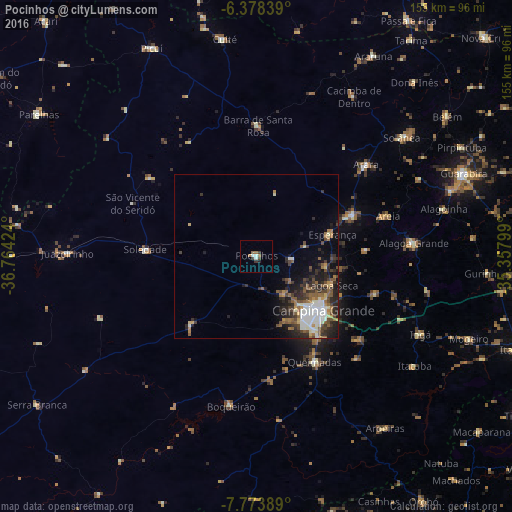
Analysis of Pocinhos night lights 2016
Square area 10x10 km:
 0.87%
0.87%90-99
1.73%80-89
0%70-79
0%60-69
2.16%50-59
1.3%40-49
1.3%30-39
2.16%20-29
0.87%10-19
0.87%0-9
88.74%Square area 50x50 km:
1.45%90-99
1.59%80-89
0.61%70-79
0.61%60-69
1.18%50-59
1.81%40-49
1.43%30-39
1.74%20-29
3.26%10-19
3.44%0-9
82.87%Clear (daylight) street map image can be seen on geolist.org.
Map coordinates:
6° 22' 42.2" South, 36° 45' 51.3" West
7° 4' 36" South, 36° 3' 40" West
7° 46' 26" South, 35° 21' 28.8" West
Some cities around Pocinhos sort by population:
• Campina Grande
26.2 km =16.3 mi,  130°
130°
• Esperança
23 km =14.3 mi,  77°
77°
• Areia
42.7 km =26.5 mi,  72°
72°
• Remígio
34.2 km =21.3 mi,  64°
64°
• Alagoa Nova
33.4 km =20.8 mi,  88°
88°
• Lagoa Seca
25.2 km =15.7 mi,  114°
114°
• Soledade
33.4 km =20.8 mi,  273°
273°
• Arara
43.4 km =27 mi,  50°
50°
3391762 (p: 7,803)
Sources (retrieved 2019-11-25):
» Earth at Night: Flat Maps 2012, 2016