Soledade night lights from space
Night Light of Soledade (Paraíba) from space (Brazil) Src. Average luminocity for 10x10km area is 6.316% and for 50x50km: 1.1591%.
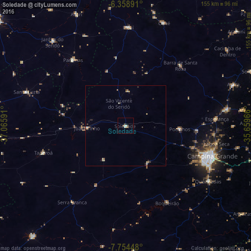
Analysis of Soledade night lights 2016
Square area 10x10 km:
 1.08%
1.08%90-99
1.52%80-89
0%70-79
0.87%60-69
0.87%50-59
2.38%40-49
0.22%30-39
0%20-29
0.87%10-19
0%0-9
92.21%Square area 50x50 km:
0.12%90-99
0.22%80-89
0.13%70-79
0.15%60-69
0.18%50-59
0.16%40-49
0.15%30-39
0.16%20-29
0.26%10-19
0.22%0-9
98.24%Clear (daylight) street map image can be seen on geolist.org.
Map coordinates:
6° 21' 32.1" South, 37° 3' 57.3" West
7° 3' 26" South, 36° 21' 46" West
7° 45' 16.1" South, 35° 39' 34.8" West
Some cities around Soledade sort by population:
• Campina Grande
56.5 km =35.1 mi,  109°
109°
• Esperança
55.9 km =34.7 mi,  87°
87°
• Parelhas
52.4 km =32.6 mi,  321°
321°
• Boqueirão
53.6 km =33.3 mi,  151°
151°
• Picuí
60.8 km =37.8 mi,  1°
1°
• Taperoá
53.8 km =33.4 mi,  251°
251°
• Lagoa Seca
57.6 km =35.8 mi,  102°
102°
• Pocinhos
33.4 km =20.8 mi, 93°
3387258 (p: 8,090)
Sources (retrieved 2019-11-25):
» Earth at Night: Flat Maps 2012, 2016