Piracicaba night lights from space
Night Light of Piracicaba (São Paulo) from space (Brazil) Src. Average luminocity for 10x10km area is 88.5794% and for 50x50km: 22.0009%.
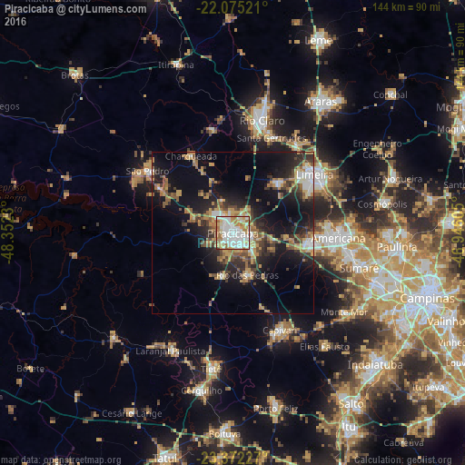
Analysis of Piracicaba night lights 2016
Square area 10x10 km:
 32.14%
90-99
30.56%80-89
9.92%70-79
10.12%60-69
13.69%50-59
2.78%40-49
0.6%30-39
0.2%20-29
0%10-19
0%0-9
0%Square area 50x50 km:
2.66%90-99
2.96%80-89
2.27%70-79
4.27%60-69
3.24%50-59
2.97%40-49
3%30-39
4.07%20-29
6.31%10-19
14.67%0-9
53.58%Clear (daylight) street map image can be seen on geolist.org.
Map coordinates:
22° 4' 30.8" South, 48° 21' 8.3" West
22° 43' 31" South, 47° 38' 57" West
23° 22' 20.2" South, 46° 56' 45.8" West
Some cities around Piracicaba sort by population:
• Limeira
31 km =19.3 mi,  54°
54°
• Americana
32.6 km =20.3 mi,  92°
92°
• Santa Bárbara d'Oeste
24.4 km =15.2 mi,  97°
97°
• Capivari
33.3 km =20.7 mi,  154°
154°
• Rio das Pedras
13.8 km =8.6 mi,  161°
161°
• Santa Gertrudes
32.3 km =20.1 mi,  22°
22°
• Iracemápolis
20.9 km =13 mi,  39°
39°
• Charqueada
27.4 km =17 mi,  331°
331°
3453643 (p: 342,209)
Sources (retrieved 2019-11-25):
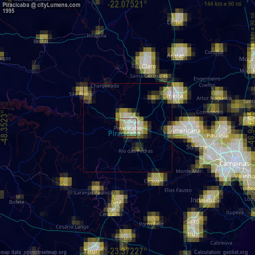
» NASA, Earths city lights 1995
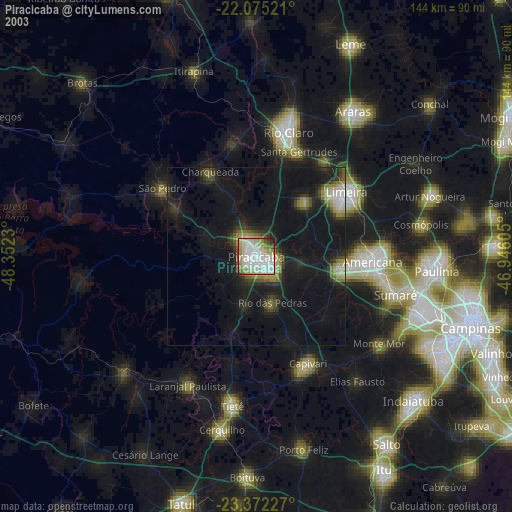
» NASA city lights 2003
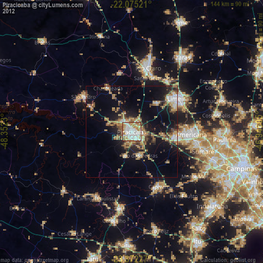
» Earth at Night: Flat Maps 2012, 2016