Peruíbe night lights from space
Night Light of Peruíbe (São Paulo) from space (Brazil) Src. Average luminocity for 10x10km area is 42.4034% and for 50x50km: 6.7371%.
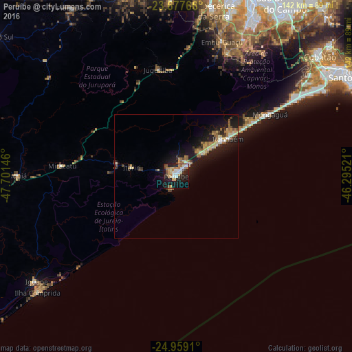
Analysis of Peruíbe night lights 2016
Square area 10x10 km:
 7.39%
7.39%90-99
7.58%80-89
6.06%70-79
7.39%60-69
7.58%50-59
4.92%40-49
1.89%30-39
2.84%20-29
9.28%10-19
33.71%0-9
11.36%Square area 50x50 km:
0.6%90-99
0.79%80-89
1.06%70-79
1.1%60-69
1.15%50-59
0.86%40-49
0.52%30-39
0.78%20-29
1.63%10-19
7.54%0-9
83.98%Clear (daylight) street map image can be seen on geolist.org.
Map coordinates:
23° 40' 39.6" South, 47° 42' 5.3" West
24° 19' 12" South, 46° 59' 54" West
24° 57' 32.8" South, 46° 17' 42.8" West
Some cities around Peruíbe sort by population:
• Itapecerica da Serra
68.7 km =42.7 mi,  12°
12°
• Itanhaém
26.1 km =16.2 mi,  54°
54°
• Embu Guaçu
57.5 km =35.7 mi,  19°
19°
• Mongaguá
45.9 km =28.5 mi,  56°
56°
• Juquitiba
43.8 km =27.2 mi,  350°
350°
• Juquiá
64.5 km =40.1 mi,  269°
269°
• São Lourenço da Serra
52.3 km =32.5 mi, 6°
• Miracatu
47 km =29.2 mi,  275°
275°
3454061 (p: 63,030)
Sources (retrieved 2019-11-25):
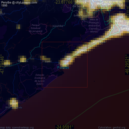
» NASA, Earths city lights 1995
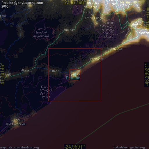
» NASA city lights 2003
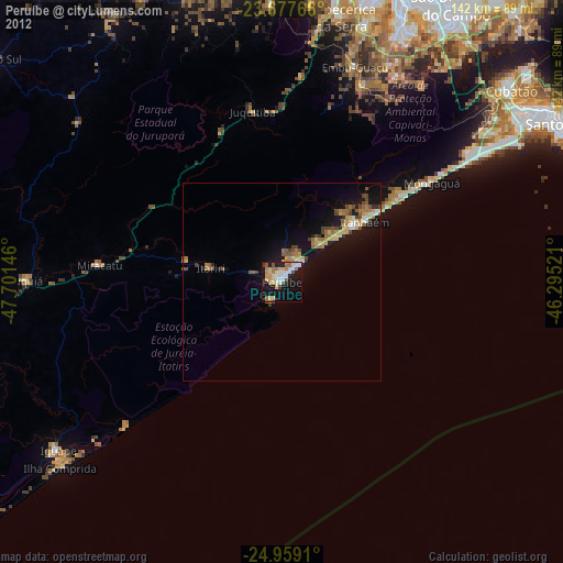
» Earth at Night: Flat Maps 2012, 2016