Penedo night lights from space
Night Light of Penedo (Alagoas) from space (Brazil) Src. Average luminocity for 10x10km area is 40.8223% and for 50x50km: 6.016%.
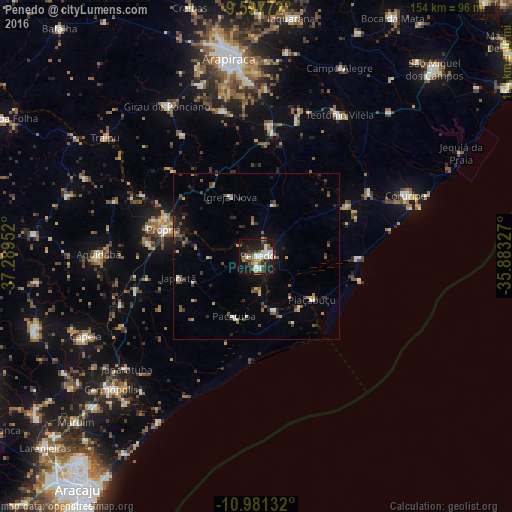
Analysis of Penedo night lights 2016
Square area 10x10 km:
 3.1%
3.1%90-99
15.5%80-89
2.07%70-79
3.72%60-69
2.27%50-59
8.47%40-49
6.2%30-39
4.55%20-29
9.3%10-19
36.57%0-9
8.26%Square area 50x50 km:
0.17%90-99
1.14%80-89
0.36%70-79
0.57%60-69
0.56%50-59
1.42%40-49
0.93%30-39
1.2%20-29
1.62%10-19
4.12%0-9
87.92%Clear (daylight) street map image can be seen on geolist.org.
Map coordinates:
9° 35' 51.8" South, 37° 17' 22.3" West
10° 17' 25" South, 36° 35' 11" West
10° 58' 52.8" South, 35° 52' 59.8" West
Some cities around Penedo sort by population:
• Coruripe
48.5 km =30.1 mi,  67°
67°
• Propriá
29.1 km =18.1 mi,  287°
287°
• Neópolis
3.4 km =2.1 mi,  167°
167°
• Aquidabã
47.3 km =29.4 mi,  271°
271°
• Piaçabuçu
21 km =13 mi,  127°
127°
• São Sebastião
39.8 km =24.7 mi,  5°
5°
• Junqueiro
42.4 km =26.3 mi,  16°
16°
• Porto Real do Colégio
30.1 km =18.7 mi, 292°
3454231 (p: 42,097)
Sources (retrieved 2019-11-25):
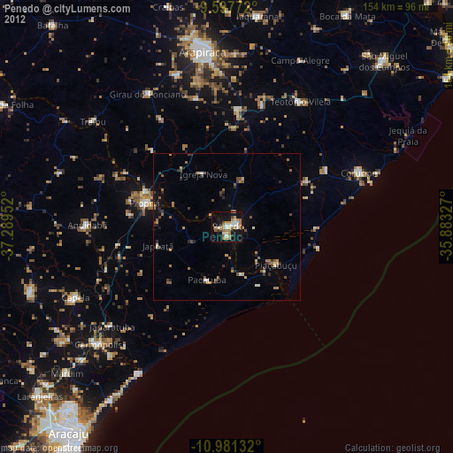
» Earth at Night: Flat Maps 2012, 2016