Paranavaí night lights from space
Night Light of Paranavaí (Paraná) from space (Brazil) Src. Average luminocity for 10x10km area is 50.7746% and for 50x50km: 4.9204%.
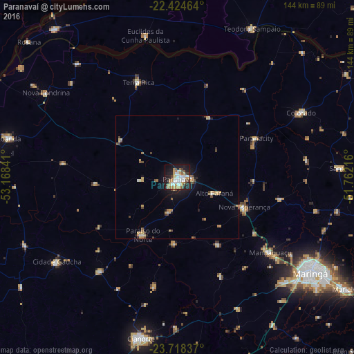

Analysis of Paranavaí night lights 2016
Square area 10x10 km:
 11.36%
90-99
10.61%80-89
7.95%70-79
7.58%60-69
6.63%50-59
3.41%40-49
4.55%30-39
3.98%20-29
12.5%10-19
27.46%0-9
3.98%Square area 50x50 km:
0.56%90-99
0.64%80-89
0.86%70-79
0.82%60-69
0.59%50-59
0.38%40-49
0.75%30-39
0.4%20-29
0.82%10-19
3.1%0-9
91.07%Clear (daylight) street map image can be seen on geolist.org.
Map coordinates:
22° 25' 28.7" South, 53° 10' 6.3" West
23° 4' 23" South, 52° 27' 55" West
23° 43' 6.1" South, 51° 45' 43.8" West
Some cities around Paranavaí sort by population:
• Maringá
66.5 km =41.3 mi,  126°
126°
• Paiçandu
60.3 km =37.5 mi,  135°
135°
• Colorado
56.8 km =35.3 mi,  62°
62°
• Mandaguaçu
48.6 km =30.2 mi, 128°
• Nova Londrina
63.2 km =39.3 mi,  302°
302°
• Alto Paraná
16.2 km =10.1 mi,  112°
112°
• Terra Rica
43.3 km =26.9 mi,  338°
338°
• Nova Aurora
25.2 km =15.7 mi, 335°
3455051 (p: 72,848)
Sources (retrieved 2019-11-25):
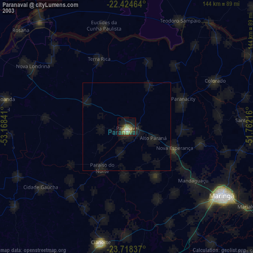
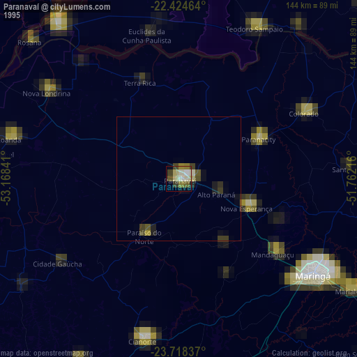
» NASA, Earths city lights 1995
» NASA city lights 2003
» Earth at Night: Flat Maps 2012, 2016