Paracatu night lights from space
Night Light of Paracatu (Minas Gerais) from space (Brazil) Src. Average luminocity for 10x10km area is 40.9008% and for 50x50km: 2.4128%.
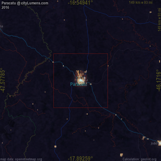
Analysis of Paracatu night lights 2016
Square area 10x10 km:
 3.31%
3.31%90-99
6.61%80-89
3.72%70-79
8.47%60-69
8.47%50-59
7.02%40-49
10.95%30-39
3.31%20-29
5.79%10-19
35.33%0-9
7.02%Square area 50x50 km:
0.13%90-99
0.26%80-89
0.15%70-79
0.52%60-69
0.39%50-59
0.47%40-49
0.6%30-39
0.25%20-29
0.34%10-19
2.27%0-9
94.62%Clear (daylight) street map image can be seen on geolist.org.
Map coordinates:
16° 32' 57.9" South, 47° 34' 40.3" West
17° 13' 20" South, 46° 52' 29" West
17° 53' 33.3" South, 46° 10' 17.8" West
Some cities around Paracatu sort by population:
• Unaí
96.2 km =59.8 mi,  358°
358°
• Cristalina
93.6 km =58.2 mi,  302°
302°
• João Pinheiro
94.3 km =58.6 mi,  127°
127°
• Pires do Rio
149.4 km =92.8 mi,  266°
266°
• Coromandel
143.3 km =89 mi,  193°
193°
• Ipameri
147.2 km =91.5 mi,  247°
247°
• Vazante
85.1 km =52.9 mi,  182°
182°
• Presidente Olegário
141.4 km =87.9 mi,  160°
160°
3455168 (p: 70,753)
Sources (retrieved 2019-11-25):
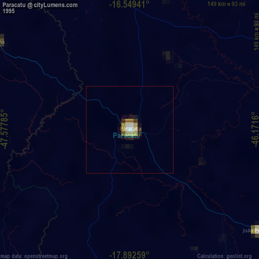
» NASA, Earths city lights 1995
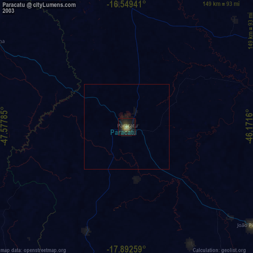
» NASA city lights 2003
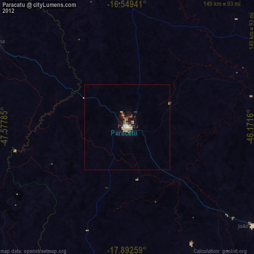
» Earth at Night: Flat Maps 2012, 2016