Nuporanga night lights from space
Night Light of Nuporanga (São Paulo) from space (Brazil) Src. Average luminocity for 10x10km area is 6.2689% and for 50x50km: 4.4974%.
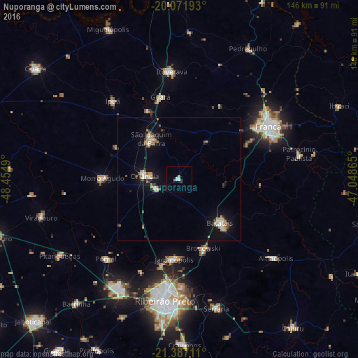
Analysis of Nuporanga night lights 2016
Square area 10x10 km:
 0.95%
0.95%90-99
2.08%80-89
0%70-79
0.76%60-69
0.76%50-59
0%40-49
0%30-39
1.52%20-29
0.38%10-19
1.89%0-9
91.67%Square area 50x50 km:
0.56%90-99
0.64%80-89
0.26%70-79
0.83%60-69
0.61%50-59
0.54%40-49
0.41%30-39
0.42%20-29
0.45%10-19
3.7%0-9
91.59%Clear (daylight) street map image can be seen on geolist.org.
Map coordinates:
20° 4' 18.9" South, 48° 27' 17.6" West
20° 43' 51.4" South, 47° 45' 6.4" West
21° 23' 13.6" South, 47° 2' 55.1" West
Some cities around Nuporanga sort by population:
• Franca
42.3 km =26.3 mi,  59°
59°
• Batatais
24.9 km =15.5 mi,  135°
135°
• Orlândia
14.1 km =8.8 mi,  274°
274°
• São Joaquim da Barra
19.8 km =12.3 mi,  327°
327°
• Jardinópolis
31.9 km =19.8 mi,  182°
182°
• Morro Agudo
31.8 km =19.8 mi, 269°
• Brodósqui
30.5 km =19 mi,  161°
161°
• Guará
34.5 km =21.4 mi,  347°
347°
3456037 (p: 6,900)
Sources (retrieved 2019-11-25):
» Earth at Night: Flat Maps 2012, 2016