Franca night lights from space
Night Light of Franca (São Paulo) from space (Brazil) Src. Average luminocity for 10x10km area is 79.6117% and for 50x50km: 6.9507%.
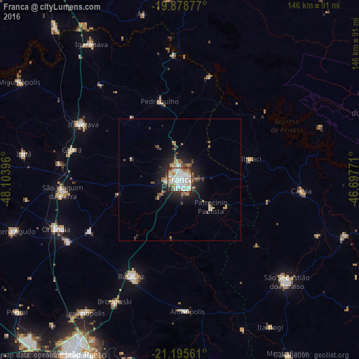
Analysis of Franca night lights 2016
Square area 10x10 km:
 27.65%
90-99
26.89%80-89
4.73%70-79
11.36%60-69
7.58%50-59
4.92%40-49
5.49%30-39
4.36%20-29
7.01%10-19
0%0-9
0%Square area 50x50 km:
1.32%90-99
1.34%80-89
0.34%70-79
1.21%60-69
0.85%50-59
0.59%40-49
0.96%30-39
0.69%20-29
2.01%10-19
4.45%0-9
86.23%Clear (daylight) street map image can be seen on geolist.org.
Map coordinates:
19° 52' 43.6" South, 48° 6' 14.3" West
20° 32' 19" South, 47° 24' 3" West
21° 11' 44.2" South, 46° 41' 51.8" West
Some cities around Franca sort by population:
• Batatais
43.6 km =27.1 mi,  206°
206°
• São Joaquim da Barra
47.5 km =29.5 mi,  264°
264°
• Ituverava
45.3 km =28.1 mi,  299°
299°
• Guará
45.8 km =28.5 mi,  285°
285°
• Altinópolis
54.2 km =33.7 mi,  177°
177°
• Cássia
50.1 km =31.1 mi,  95°
95°
• Pedregulho
32.3 km =20.1 mi,  345°
345°
• Nuporanga
42.3 km =26.3 mi,  239°
239°
3463011 (p: 305,041)
Sources (retrieved 2019-11-25):
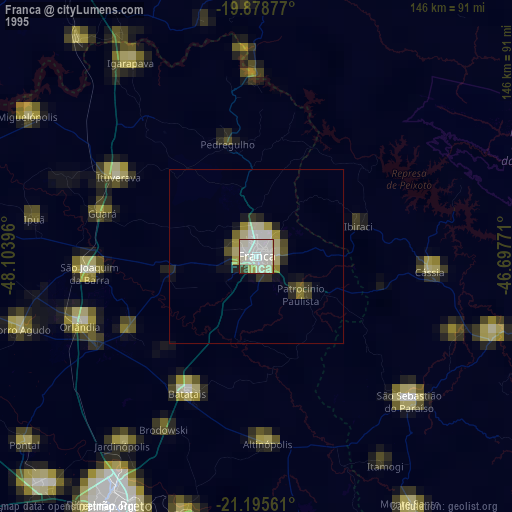
» NASA, Earths city lights 1995
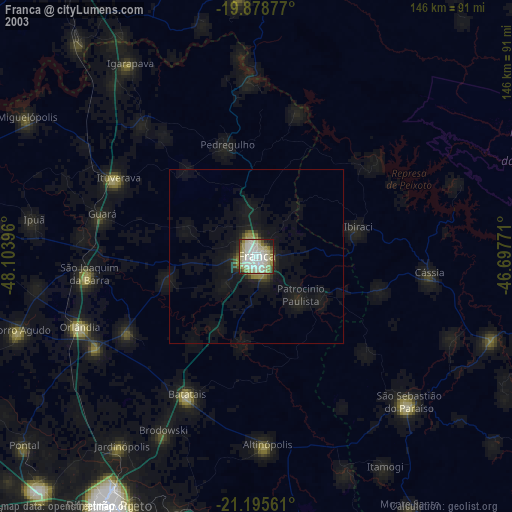
» NASA city lights 2003
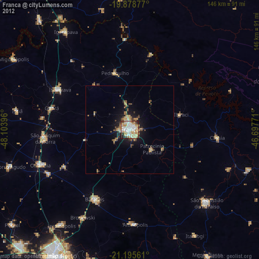
» Earth at Night: Flat Maps 2012, 2016