Novo Hamburgo night lights from space
Night Light of Novo Hamburgo (Rio Grande do Sul) from space (Brazil) Src. Average luminocity for 10x10km area is 79.8274% and for 50x50km: 25.7066%.
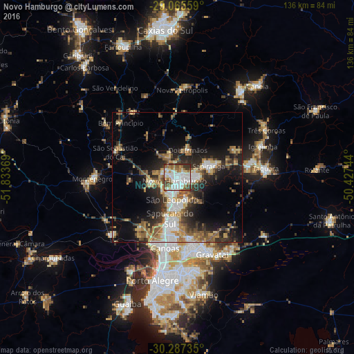
Analysis of Novo Hamburgo night lights 2016
Square area 10x10 km:
 32.74%
90-99
20.24%80-89
6.94%70-79
5.36%60-69
10.52%50-59
9.33%40-49
6.55%30-39
8.13%20-29
0.2%10-19
0%0-9
0%Square area 50x50 km:
4.42%90-99
3.74%80-89
3.14%70-79
3.18%60-69
4.03%50-59
4.22%40-49
3.26%30-39
4.97%20-29
7.17%10-19
11.1%0-9
50.75%Clear (daylight) street map image can be seen on geolist.org.
Map coordinates:
29° 3' 56.1" South, 51° 50' 1.3" West
29° 40' 42" South, 51° 7' 50" West
30° 17' 14.5" South, 50° 25' 38.8" West
Some cities around Novo Hamburgo sort by population:
• São Leopoldo
9.3 km =5.8 mi,  190°
190°
• Sapucaia
17.3 km =10.7 mi, 186°
• Esteio
20.9 km =13 mi, 192°
• Sapiranga
12.8 km =8 mi,  69°
69°
• Estância Velha
5.4 km =3.4 mi,  308°
308°
• Portão
11.1 km =6.9 mi,  256°
256°
• São Sebastião do Caí
25.8 km =16 mi,  293°
293°
• Ivoti
10.1 km =6.3 mi,  343°
343°
3456068 (p: 253,841)
Sources (retrieved 2019-11-25):
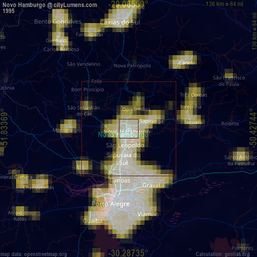
» NASA, Earths city lights 1995
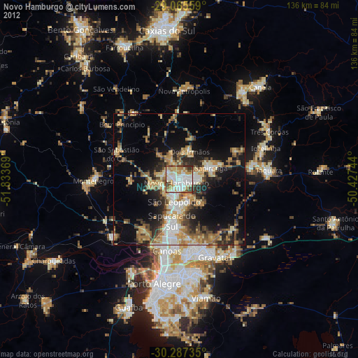
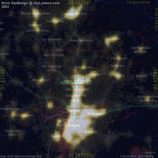
» NASA city lights 2003
» Earth at Night: Flat Maps 2012, 2016