São Leopoldo night lights from space
Night Light of São Leopoldo (Rio Grande do Sul) from space (Brazil) Src. Average luminocity for 10x10km area is 78.002% and for 50x50km: 35.2043%.
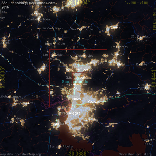
Analysis of São Leopoldo night lights 2016
Square area 10x10 km:
 24.01%
90-99
22.62%80-89
11.71%70-79
6.75%60-69
10.32%50-59
8.53%40-49
4.56%30-39
7.94%20-29
3.57%10-19
0%0-9
0%Square area 50x50 km:
7.65%90-99
6.08%80-89
4.78%70-79
4.66%60-69
4.66%50-59
5.1%40-49
3.67%30-39
5.41%20-29
7.97%10-19
12.23%0-9
37.78%Clear (daylight) street map image can be seen on geolist.org.
Map coordinates:
29° 8' 52.9" South, 51° 51' 1.3" West
29° 45' 37" South, 51° 8' 50" West
30° 22' 7.7" South, 50° 26' 38.8" West
Some cities around São Leopoldo sort by population:
• Canoas
17.9 km =11.1 mi,  191°
191°
• Novo Hamburgo
9.3 km =5.8 mi,  10°
10°
• Sapucaia
8.1 km =5 mi,  181°
181°
• Esteio
11.7 km =7.3 mi,  195°
195°
• Sapiranga
19.2 km =11.9 mi,  44°
44°
• Estância Velha
12.7 km =7.9 mi,  348°
348°
• Portão
11.2 km =7 mi,  305°
305°
• Ivoti
18.9 km =11.7 mi,  356°
356°
3448622 (p: 209,229)
Sources (retrieved 2019-11-25):
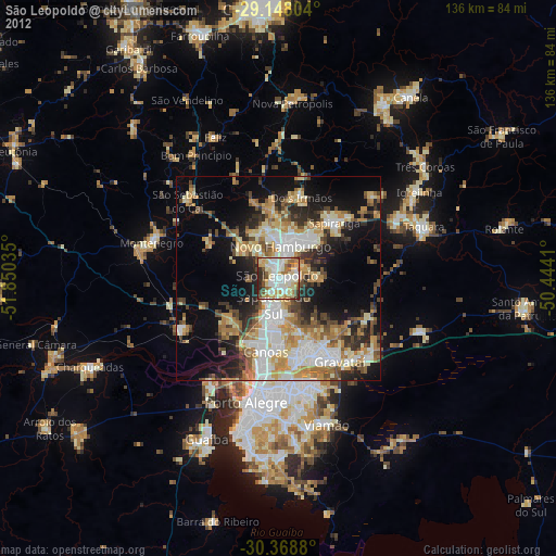
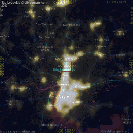
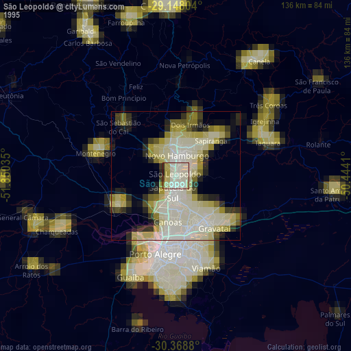
» NASA, Earths city lights 1995
» NASA city lights 2003
» Earth at Night: Flat Maps 2012, 2016