Montenegro night lights from space
Night Light of Montenegro (Rio Grande do Sul) from space (Brazil) Src. Average luminocity for 10x10km area is 28.2758% and for 50x50km: 8.3385%.
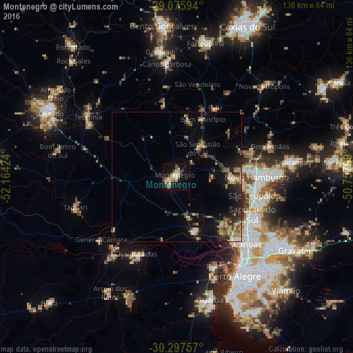
Analysis of Montenegro night lights 2016
Square area 10x10 km:
 1.98%
1.98%90-99
4.37%80-89
4.96%70-79
5.36%60-69
2.78%50-59
5.75%40-49
4.76%30-39
1.59%20-29
1.98%10-19
29.17%0-9
37.3%Square area 50x50 km:
0.39%90-99
0.46%80-89
1.29%70-79
1.44%60-69
1.13%50-59
1.55%40-49
1.43%30-39
1.5%20-29
2.55%10-19
5.4%0-9
82.85%Clear (daylight) street map image can be seen on geolist.org.
Map coordinates:
29° 4' 33.4" South, 52° 9' 51.3" West
29° 41' 19" South, 51° 27' 40" West
30° 17' 51.3" South, 50° 45' 28.8" West
Some cities around Montenegro sort by population:
• Novo Hamburgo
32 km =19.9 mi,  87°
87°
• São Leopoldo
31.3 km =19.4 mi,  104°
104°
• Esteio
33.3 km =20.7 mi,  125°
125°
• Estância Velha
28.1 km =17.5 mi,  80°
80°
• Charqueadas
33.6 km =20.9 mi,  208°
208°
• Portão
21.2 km =13.2 mi, 93°
• São Sebastião do Caí
14 km =8.7 mi,  36°
36°
• Ivoti
31 km =19.3 mi,  69°
69°
3456826 (p: 54,057)
Sources (retrieved 2019-11-25):
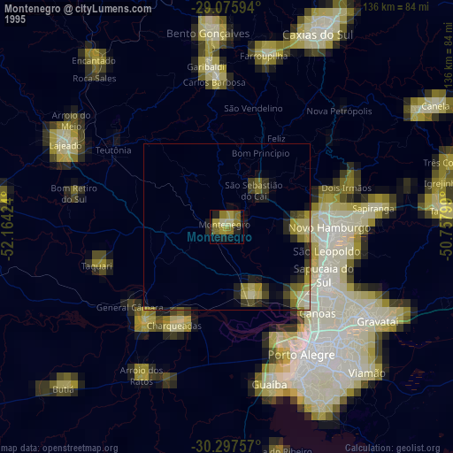
» NASA, Earths city lights 1995
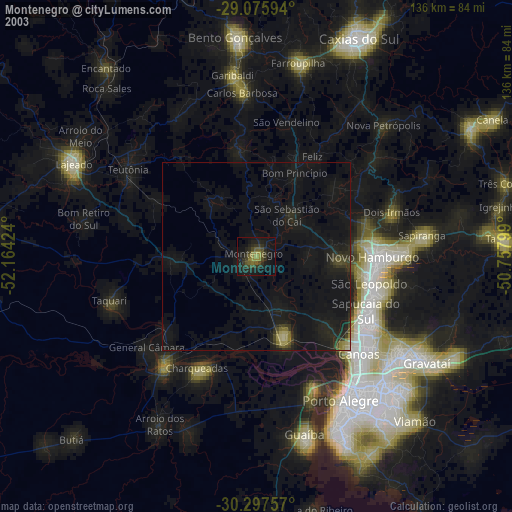
» NASA city lights 2003
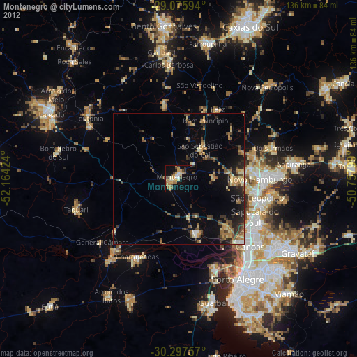
» Earth at Night: Flat Maps 2012, 2016