Mazagão night lights from space
Night Light of Mazagão (Amapá) from space (Brazil) Src. Average luminocity for 10x10km area is 5.2727% and for 50x50km: 8.2677%.
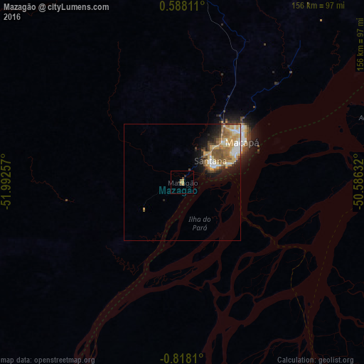
Analysis of Mazagão night lights 2016
Square area 10x10 km:
 0%
0%90-99
0%80-89
0.22%70-79
3.25%60-69
0.87%50-59
0.87%40-49
0.87%30-39
0%20-29
1.73%10-19
0%0-9
92.21%Square area 50x50 km:
0.99%90-99
1.13%80-89
1.64%70-79
1.99%60-69
1.11%50-59
1.48%40-49
1.27%30-39
0.67%20-29
1.3%10-19
3.16%0-9
85.26%Clear (daylight) street map image can be seen on geolist.org.
Map coordinates:
0° 35' 17.2" North, 51° 59' 33.3" West
0° 6' 54" South, 51° 17' 22" West
0° 49' 5.2" South, 50° 35' 10.8" West
Some cities around Mazagão sort by population:
• Macapá
30.1 km =18.7 mi,  55°
55°
• Santana
13.5 km =8.4 mi, 62°
• Breves
196.1 km =121.9 mi,  152°
152°
• Portel
209 km =129.9 mi,  165°
165°
• Tucumã
138 km =85.7 mi,  93°
93°
• Porto de Moz
210 km =130.5 mi,  210°
210°
• Afuá
100.5 km =62.4 mi, 92°
• Gurupá
148.6 km =92.3 mi,  195°
195°
3395042 (p: 6,500)
Sources (retrieved 2019-11-25):
» Earth at Night: Flat Maps 2012, 2016