Macapá night lights from space
Night Light of Macapá (Amapá) from space (Brazil) Src. Average luminocity for 10x10km area is 75.5087% and for 50x50km: 10.8607%.
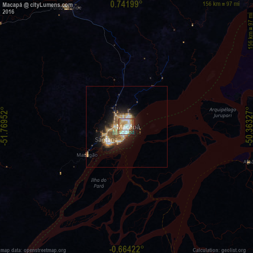
Analysis of Macapá night lights 2016
Square area 10x10 km:
 22.29%
90-99
16.67%80-89
10.17%70-79
19.48%60-69
6.71%50-59
3.46%40-49
10.17%30-39
6.93%20-29
2.6%10-19
1.52%0-9
0%Square area 50x50 km:
1.44%90-99
1.45%80-89
1.81%70-79
2.21%60-69
1.17%50-59
1.66%40-49
2.02%30-39
1.35%20-29
2.26%10-19
5.82%0-9
78.82%Clear (daylight) street map image can be seen on geolist.org.
Map coordinates:
0° 44' 31.2" North, 51° 46' 10.3" West
0° 2' 20" North, 51° 3' 59" West
0° 39' 51.2" South, 50° 21' 47.8" West
Some cities around Macapá sort by population:
• Santana
16.8 km =10.4 mi,  229°
229°
• Breves
202.2 km =125.6 mi,  161°
161°
• Portel
221.2 km =137.4 mi,  172°
172°
• Tucumã
115.7 km =71.9 mi,  102°
102°
• Porto de Moz
237.6 km =147.6 mi,  213°
213°
• Afuá
78.6 km =48.8 mi,  106°
106°
• Mazagão
30.1 km =18.7 mi,  235°
235°
• Gurupá
172.7 km =107.3 mi,  201°
201°
3396016 (p: 338,936)
Sources (retrieved 2019-11-25):
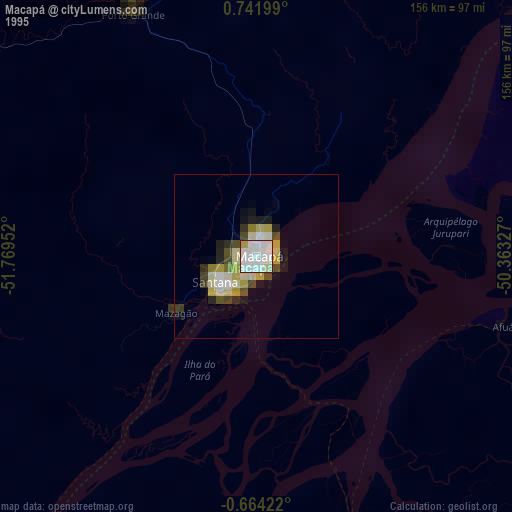
» NASA, Earths city lights 1995
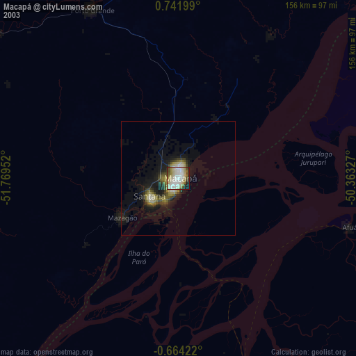
» NASA city lights 2003
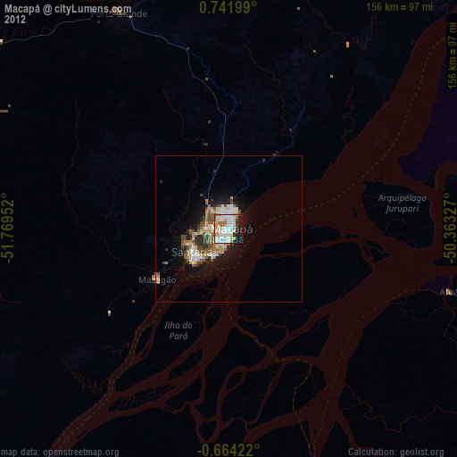
» Earth at Night: Flat Maps 2012, 2016