Martinho Campos night lights from space
Night Light of Martinho Campos (Minas Gerais) from space (Brazil) Src. Average luminocity for 10x10km area is 9.8264% and for 50x50km: 1.4523%.
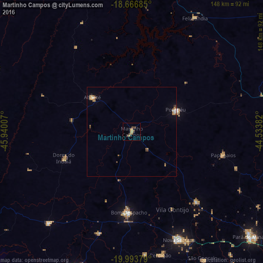
Analysis of Martinho Campos night lights 2016
Square area 10x10 km:
 0%
0%90-99
0%80-89
0.83%70-79
4.13%60-69
3.31%50-59
0%40-49
2.89%30-39
2.48%20-29
0.41%10-19
0.21%0-9
85.74%Square area 50x50 km:
0.08%90-99
0.1%80-89
0.11%70-79
0.5%60-69
0.36%50-59
0.15%40-49
0.27%30-39
0.2%20-29
0.05%10-19
0.2%0-9
97.98%Clear (daylight) street map image can be seen on geolist.org.
Map coordinates:
18° 40' 0.7" South, 45° 56' 24.3" West
19° 19' 54" South, 45° 14' 13" West
19° 59' 37.6" South, 44° 32' 1.8" West
Some cities around Martinho Campos sort by population:
• Lagoa da Prata
83.3 km =51.8 mi,  202°
202°
• Bom Despacho
45 km =28 mi,  182°
182°
• Pompéu
33.8 km =21 mi,  69°
69°
• Abaeté
29.1 km =18.1 mi,  311°
311°
• Pitangui
53.3 km =33.1 mi,  137°
137°
• Luz
70.3 km =43.7 mi,  221°
221°
• Dores do Indaiá
41 km =25.5 mi,  249°
249°
• Papagaios
52.9 km =32.9 mi,  104°
104°
3457598 (p: 9,197)
Sources (retrieved 2019-11-25):
» Earth at Night: Flat Maps 2012, 2016