Abaeté night lights from space
Night Light of Abaeté (Minas Gerais) from space (Brazil) Src. Average luminocity for 10x10km area is 11.2554% and for 50x50km: 1.0053%.
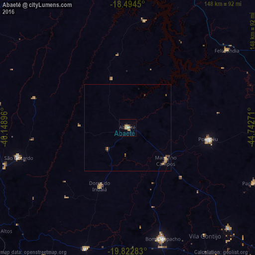
Analysis of Abaeté night lights 2016
Square area 10x10 km:
 0%
0%90-99
0.87%80-89
1.73%70-79
5.41%60-69
2.38%50-59
0.43%40-49
0.43%30-39
1.73%20-29
0.87%10-19
0.43%0-9
85.71%Square area 50x50 km:
0%90-99
0.03%80-89
0.11%70-79
0.43%60-69
0.25%50-59
0.06%40-49
0.16%30-39
0.23%20-29
0.13%10-19
0.11%0-9
98.5%Clear (daylight) street map image can be seen on geolist.org.
Map coordinates:
18° 29' 40.2" South, 46° 8' 56.3" West
19° 9' 36" South, 45° 26' 45" West
19° 49' 22.2" South, 44° 44' 33.8" West
Some cities around Abaeté sort by population:
• Bom Despacho
67.2 km =41.8 mi,  162°
162°
• São Gotardo
65.5 km =40.7 mi,  255°
255°
• Pompéu
54.1 km =33.6 mi,  97°
97°
• Pitangui
82.3 km =51.1 mi,  134°
134°
• Luz
75.6 km =47 mi,  199°
199°
• Dores do Indaiá
37.5 km =23.3 mi,  205°
205°
• Papagaios
80 km =49.7 mi,  113°
113°
• Martinho Campos
29.1 km =18.1 mi, 131°
3473267 (p: 20,370)
Sources (retrieved 2019-11-25):
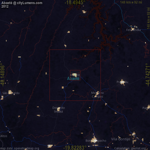
» Earth at Night: Flat Maps 2012, 2016