Luz night lights from space
Night Light of Luz (Minas Gerais) from space (Brazil) Src. Average luminocity for 10x10km area is 10.0021% and for 50x50km: 1.0802%.
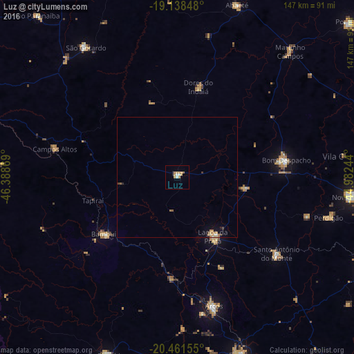
Analysis of Luz night lights 2016
Square area 10x10 km:
 1.03%
1.03%90-99
1.45%80-89
0.83%70-79
5.58%60-69
0.83%50-59
0.21%40-49
0%30-39
0%20-29
0%10-19
0%0-9
90.08%Square area 50x50 km:
0.06%90-99
0.12%80-89
0.13%70-79
0.39%60-69
0.18%50-59
0.09%40-49
0.11%30-39
0.03%20-29
0.06%10-19
0.29%0-9
98.53%Clear (daylight) street map image can be seen on geolist.org.
Map coordinates:
19° 8' 18.5" South, 46° 23' 19.3" West
19° 48' 5" South, 45° 41' 8" West
20° 27' 41.6" South, 44° 58' 56.8" West
Some cities around Luz sort by population:
• Lagoa da Prata
28.7 km =17.8 mi,  148°
148°
• Bom Despacho
45.9 km =28.5 mi,  80°
80°
• São Gotardo
66.5 km =41.3 mi,  325°
325°
• Arcos
55.6 km =34.5 mi,  164°
164°
• Santo Antônio do Monte
51.8 km =32.2 mi,  127°
127°
• Bambuí
38 km =23.6 mi,  233°
233°
• Dores do Indaiá
38.6 km =24 mi,  13°
13°
• Campos Altos
52.2 km =32.4 mi,  282°
282°
3458333 (p: 14,396)
Sources (retrieved 2019-11-25):
» Earth at Night: Flat Maps 2012, 2016