Linhares night lights from space
Night Light of Linhares (Espírito Santo) from space (Brazil) Src. Average luminocity for 10x10km area is 48.5455% and for 50x50km: 5.7815%.
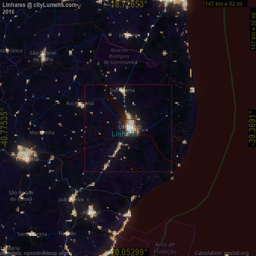
Analysis of Linhares night lights 2016
Square area 10x10 km:
 11.57%
90-99
9.09%80-89
7.02%70-79
6.4%60-69
0.62%50-59
5.37%40-49
10.12%30-39
9.71%20-29
7.23%10-19
28.93%0-9
3.93%Square area 50x50 km:
0.64%90-99
0.51%80-89
1.1%70-79
0.76%60-69
0.29%50-59
0.62%40-49
1.27%30-39
1%20-29
1.18%10-19
3.83%0-9
88.82%Clear (daylight) street map image can be seen on geolist.org.
Map coordinates:
18° 43' 35.5" South, 40° 46' 31.3" West
19° 23' 28" South, 40° 4' 20" West
20° 3' 10.8" South, 39° 22' 8.8" West
Some cities around Linhares sort by population:
• Colatina
60.8 km =37.8 mi,  254°
254°
• São Mateus
77.9 km =48.4 mi,  16°
16°
• Aracruz
52.2 km =32.4 mi,  203°
203°
• Nova Venécia
83.2 km =51.7 mi,  335°
335°
• Fundão
69.7 km =43.3 mi,  209°
209°
• João Neiva
52.3 km =32.5 mi,  218°
218°
• Santa Teresa
82 km =51 mi, 222°
• Ibiraçu
58.1 km =36.1 mi, 212°
3458498 (p: 105,075)
Sources (retrieved 2019-11-25):
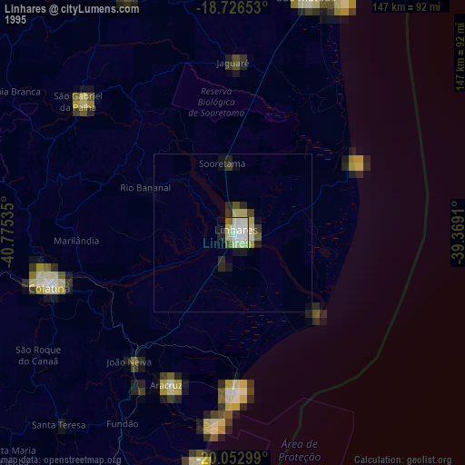
» NASA, Earths city lights 1995
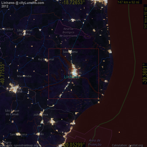
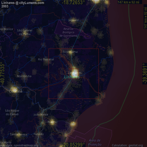
» NASA city lights 2003
» Earth at Night: Flat Maps 2012, 2016