Ibiraçu night lights from space
Night Light of Ibiraçu (Espírito Santo) from space (Brazil) Src. Average luminocity for 10x10km area is 15.5952% and for 50x50km: 6.425%.
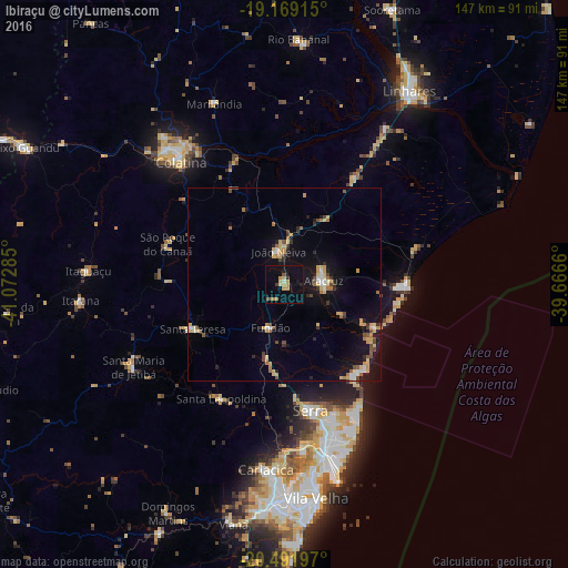
Analysis of Ibiraçu night lights 2016
Square area 10x10 km:
 0%
0%90-99
0.87%80-89
2.6%70-79
5.84%60-69
1.08%50-59
0.87%40-49
1.73%30-39
1.73%20-29
0.87%10-19
10.39%0-9
74.03%Square area 50x50 km:
0.37%90-99
0.66%80-89
1.2%70-79
1.26%60-69
0.78%50-59
0.61%40-49
0.84%30-39
0.56%20-29
0.77%10-19
5.29%0-9
87.67%Clear (daylight) street map image can be seen on geolist.org.
Map coordinates:
19° 10' 8.9" South, 41° 4' 22.3" West
19° 49' 55" South, 40° 22' 11" West
20° 29' 31.1" South, 39° 39' 59.8" West
Some cities around Ibiraçu sort by population:
• Serra
33.6 km =20.9 mi,  168°
168°
• Colatina
42.5 km =26.4 mi,  319°
319°
• Aracruz
10.2 km =6.3 mi,  82°
82°
• Santa Maria de Jetibá
44.7 km =27.8 mi,  240°
240°
• Fundão
11.9 km =7.4 mi,  197°
197°
• João Neiva
8.4 km =5.2 mi,  348°
348°
• Santa Teresa
26.7 km =16.6 mi, 244°
• Jetibá
38.8 km =24.1 mi, 237°
3461579 (p: 8,921)
Sources (retrieved 2019-11-25):
» Earth at Night: Flat Maps 2012, 2016