Jaguariaíva night lights from space
Night Light of Jaguariaíva (Paraná) from space (Brazil) Src. Average luminocity for 10x10km area is 23.0133% and for 50x50km: 2.181%.
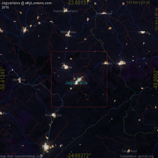

Analysis of Jaguariaíva night lights 2016
Square area 10x10 km:
 3.6%
3.6%90-99
2.46%80-89
2.27%70-79
4.73%60-69
4.17%50-59
1.7%40-49
3.41%30-39
2.46%20-29
2.46%10-19
17.05%0-9
55.68%Square area 50x50 km:
0.25%90-99
0.19%80-89
0.26%70-79
0.53%60-69
0.24%50-59
0.1%40-49
0.24%30-39
0.47%20-29
0.24%10-19
0.86%0-9
96.62%Clear (daylight) street map image can be seen on geolist.org.
Map coordinates:
23° 36' 5.4" South, 50° 24' 44.8" West
24° 14' 39.2" South, 49° 42' 33.6" West
24° 53' 1.4" South, 49° 0' 22.3" West
Some cities around Jaguariaíva sort by population:
• Itararé
41 km =25.5 mi,  69°
69°
• Ibaiti
65.5 km =40.7 mi,  312°
312°
• Piraí do Sul
39.6 km =24.6 mi,  217°
217°
• Wenceslau Braz
42.3 km =26.3 mi,  347°
347°
• Sengés
28.9 km =18 mi,  59°
59°
• Siqueira Campos
63 km =39.1 mi, 348°
• Terra Roxa
54.2 km =33.7 mi,  322°
322°
• Itaporanga
63.7 km =39.6 mi,  20°
20°
3460214 (p: 30,626)
Sources (retrieved 2019-11-25):
» Earth at Night: Flat Maps 2012, 2016