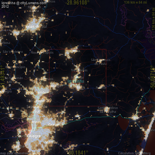
Igrejinha night lights from space
Night Light of Igrejinha (Rio Grande do Sul) from space (Brazil) Src. Average luminocity for 10x10km area is 35.1193% and for 50x50km: 11.8561%.
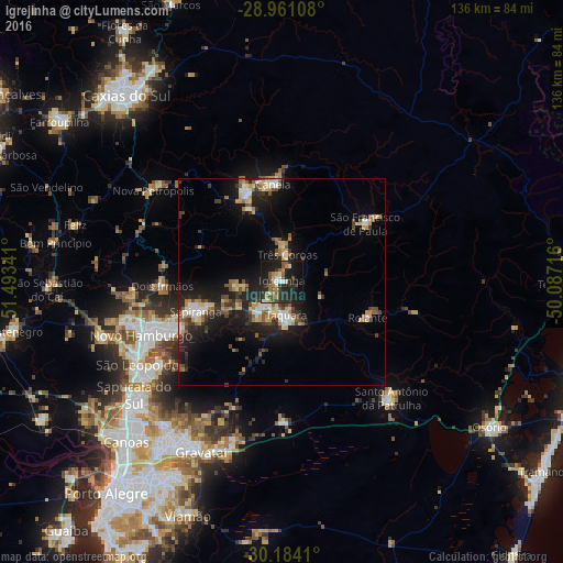
Analysis of Igrejinha night lights 2016
Square area 10x10 km:
 2.84%
2.84%90-99
3.79%80-89
5.11%70-79
3.41%60-69
6.25%50-59
6.44%40-49
4.55%30-39
6.63%20-29
19.13%10-19
35.8%0-9
6.06%Square area 50x50 km:
1.16%90-99
1.51%80-89
1.53%70-79
1.7%60-69
1.4%50-59
1.82%40-49
1.46%30-39
2.12%20-29
4.04%10-19
9.8%0-9
73.46%Clear (daylight) street map image can be seen on geolist.org.
Map coordinates:
28° 57' 39.9" South, 51° 29' 36.3" West
29° 34' 28" South, 50° 47' 25" West
30° 11' 2.8" South, 50° 5' 13.8" West
Some cities around Igrejinha sort by population:
• Novo Hamburgo
34.9 km =21.7 mi,  250°
250°
• Sapiranga
22.1 km =13.7 mi, 251°
• Parobé
7.4 km =4.6 mi,  215°
215°
• Taquara
8.5 km =5.3 mi,  173°
173°
• Canela
24.4 km =15.2 mi,  354°
354°
• Três Coroas
6.5 km =4 mi,  10°
10°
• Rolante
22.4 km =13.9 mi,  112°
112°
• São Francisco de Paula
24.4 km =15.2 mi,  54°
54°
3461481 (p: 28,679)
Sources (retrieved 2019-11-25):
» Earth at Night: Flat Maps 2012, 2016