Altinópolis night lights from space
Night Light of Altinópolis (São Paulo) from space (Brazil) Src. Average luminocity for 10x10km area is 8.9683% and for 50x50km: 2.2683%.
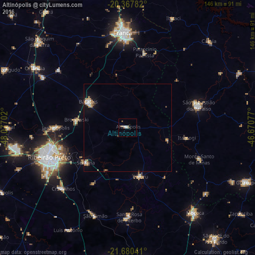
Analysis of Altinópolis night lights 2016
Square area 10x10 km:
 1.39%
1.39%90-99
2.58%80-89
0.79%70-79
0%60-69
1.59%50-59
1.98%40-49
0.4%30-39
0.2%20-29
1.39%10-19
0%0-9
89.68%Square area 50x50 km:
0.27%90-99
0.43%80-89
0.24%70-79
0.4%60-69
0.36%50-59
0.27%40-49
0.18%30-39
0.09%20-29
0.22%10-19
1.16%0-9
96.39%Clear (daylight) street map image can be seen on geolist.org.
Map coordinates:
20° 22' 4.2" South, 48° 4' 37.3" West
21° 1' 32" South, 47° 22' 26" West
21° 40' 49.5" South, 46° 40' 14.8" West
Some cities around Altinópolis sort by population:
• Ribeirão Preto
48.3 km =30 mi,  249°
249°
• São Sebastião do Paraíso
41.5 km =25.8 mi,  73°
73°
• Batatais
26.5 km =16.5 mi,  304°
304°
• Serrana
30.9 km =19.2 mi,  228°
228°
• Jardinópolis
40.5 km =25.2 mi,  271°
271°
• Cajuru
28.7 km =17.8 mi,  165°
165°
• Brodósqui
29.8 km =18.5 mi,  277°
277°
• Monte Santo de Minas
44.7 km =27.8 mi,  114°
114°
3472485 (p: 14,615)
Sources (retrieved 2019-11-25):
» Earth at Night: Flat Maps 2012, 2016